Newsroom


A list of 10 frontier scientific challenges set to define the future of remote sensing was officially released on Aug. 28 at the opening ceremony of the Second National Conference on Remote Sensing Geography held in Kashgar, northwest China's Xinjiang Uygur Autonomous Region.
Selected by a panel of experts, these challenges focus on three primary domains: fundamental theory, enabling technologies, and strategic applications. They aim to prioritize global research efforts in areas ranging from intelligent Earth observation to planetary exploration and climate impact prediction.
The initiative was jointly led by the editorial boards of the Journal of Remote Sensing and the National Remote Sensing Bulletin. The final list resulted from broad community consultation, multiple rounds of expert evaluation, and rigorous refinement to identify the most pressing gaps in current knowledge.
Nine Members of the Chinese Academy of Sciences and the Chinese Academy of Engineering, from the fields of remote sensing and related Earth sciences jointly unveiled the list at the ceremony.
Remote sensing is a fundamental tool for observing and understanding the Earth system. The integration of spaceborne, airborne, tower-based and ground-based observations with artificial intelligence, big data, digital twins and other emerging technologies is reshaping the field.
Remote sensing is now moving from static, surface-level observations toward dynamic, multi-sphere analysis and intelligent, data-driven modeling.
The Top 10 Frontier Scientific Challenges are:
1. Multi-Dimensional Radiative Transfer Mechanisms in Remote Sensing and Unified Cognitive Modeling
2. Intelligent Remote Sensing of Earth's Cycles
3. Theories and Methods for Coordinated Observation via Virtual Constellations of Remote Sensing Satellites
4. Bridging Foundation Model and AI Agent into Quantitative Inversion of Geoscience Parameters
5. Multimodal Real-Time Intelligent Processing Technology for Remote Sensing
6. Remote Sensing Detection of Habitable Planets and Planetary Habitable Environments
7. Multimodal Fusion of Remote Sensing and Social Sensing Data for Coupling Human–Natural System
8. Remote Sensing of Multi-Scale Physical Processes Inside Polar Ice Sheets
9. Global Real-Time Remote Sensing Monitoring and Early Warning Technology for Natural Disasters
10. Remote Sensing Prediction of Global Climate Change Impacts on Regional Ecosystems
To address these challenges, experts called for a closer integration of physical mechanisms with emerging technologies such as artificial intelligence, big data, and digital twins. This approach is expected to transform remote sensing from simple data acquisition into an integrated system of perception, cognition, and decision-making.
This list will serve as a strategic reference for future research planning, major scientific initiatives, and international interdisciplinary collaboration, according to the organizers. By identifying these priorities, the community aims to enhance the role of remote sensing in global sustainable development and disaster risk reduction.
Detailed analyses of these challenges have been published in both Chinese and English. The English-language perspective is currently available in the Journal of Remote Sensing in July 2026.
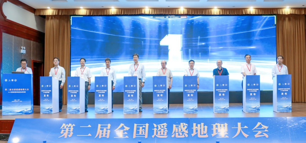
CHEN Fahu, DAI Yongjiu, HUANG Jianping, LIU Congqiang, TONG Qingxi, WANG Qiao, XIAO Wenjiao, ZHANG Bing and ZHOU Zhixin, Members of the Chinese Academy of Sciences and the Chinese Academy of Engineering, jointly unveiled the list. (Image by AIRCAS)