
Newsroom


Large earthquakes can dramatically reshape mountain landscapes by triggering thousands of landslides and rapidly accelerating erosion. However, the reasons why some mountain regions experience intense, long-lasting erosion after large earthquakes while others show only limited responses has been poorly understood.
Now, a new study published in Geology reveals that topography is the key factor controlling how mountain erosion responds to large earthquakes. By reconstructing the environmental impacts of the great AD 1717 Alpine Fault earthquake (Mw>8.0) in New Zealand, researchers from the Institute of Earth Environment of the Chinese Academy of Sciences found that differences in landscape steepness, hillslope-to-channel connectivity, and river transport capacity determine whether earthquakes mainly erode shallow surface soils or mobilize deeper materials from hillslopes and bedrock into downstream lakes.
The researchers investigated two lake catchment systems, Lake Mapourika and Lake Paringa, located along New Zealand’s Alpine Fault. The lake sediments preserve a continuous record of the earthquake cycle. To reconstruct the erosion history, the researchers combined multiple geochemical tracers, including carbon and nitrogen isotopes, and molecular biomarkers, with analyses of catchment topography and geomorphology. These geochemical fingerprints allow scientists to distinguish organic matter derived from soils of different elevations and depths, as well as from bedrock, providing a detailed record of how erosion processes changed before and after the earthquake.
Despite their similar climate, vegetation, geology, and tectonic setting, the two catchments exhibited strikingly different erosion styles, depths, and organic carbon sources. In the steeper Mapourika catchment, where hillslopes are more strongly connected to river channels, deep-seated landslides quickly carried material from deep soils and bedrock into the lake. In contrast, shallow soil erosion dominated the gentler Paringa catchment, resulting in a greater contribution of modern biospheric organic carbon derived from surface soils.
The two catchments also followed markedly different post-earthquake erosion pathways. In the Paringa catchment, the sediments deposited immediately after the earthquake were initially derived from soils at high elevations. Over time, however, they shifted toward deeper soils from lower elevations. This transition indicates that the dominant erosion process evolved from pre-earthquake surface soil erosion to earthquake-triggered bedrock landsliding. In contrast, the source elevation and erosion depth in the Mapourika catchment remained consistent before and after the earthquake. Due to its steep terrain, deep-seated bedrock landslides already dominated erosion under normal conditions, continuously eroding high-elevation soils and bedrock. The earthquake greatly increased the volume of sediment delivered to the lake, but it did not fundamentally alter the dominant erosion process.
"Earthquakes don't affect every mountain in the same way," said Dr. WANG Jin, lead author of the study. "We found that the shape of the landscape determines whether an earthquake mainly strips away surface soils or excavates much deeper material. This helps explain why similar earthquakes can leave very different geological footprints."
These findings will help scientists better predict how mountain landscapes respond to future large earthquakes and assess their impacts on sediment transport, landscape evolution, and the cycling of organic carbon in tectonically active regions. Since earthquakes redistribute enormous amounts of sediment and carbon across mountain landscapes, they influence river systems, long-term landscape evolution, and the transfer of carbon between the Earth's surface and the atmosphere. Therefore, understanding these processes is essential for evaluating the role of tectonically active mountain belts in global biogeochemical cycles and long-term climate evolution.
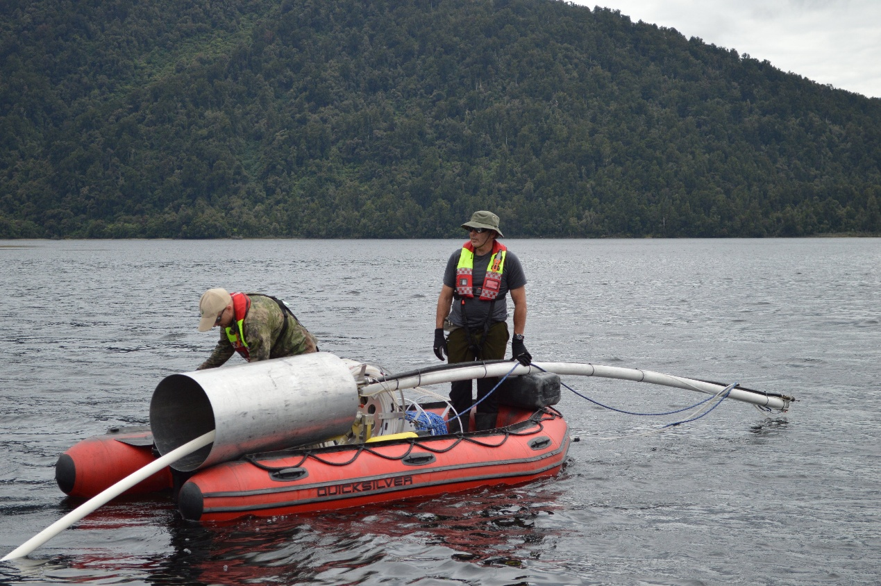
Study authors Jamie Howarth and Sean Fitzsimons collect a sediment core from Lake Paringa, New Zealand, for reconstructing the erosion history following large earthquakes. (Credit: Adelaine Moody)
