
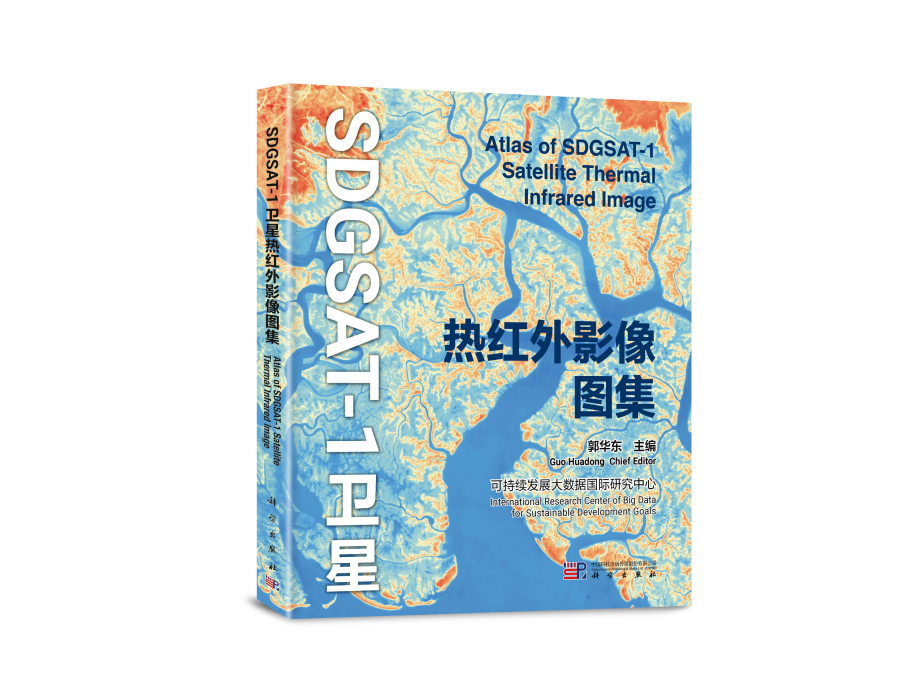
The world's first atlas of remote-sensing thermal infrared images was released in September, 2024, providing valuable data support for sustainable development research. Released by the Beijing-based International Research Center of Big Data for Sustainable Development Goals (CBAS), the atlas is based on data captured by the SDGSAT-1 satellite. Launched into space in November 2021, SDGSAT-1 is the world's first space science satellite dedicated to serving the UN 2030 Agenda for Sustainable Development.
The distribution and dynamic changes in the surface temperature on Earth are closely related to human social and economic activities, industrial production conditions, and landforms. The Atlas of SDGSAT-1 Satellite Thermal Infrared Image includes 10 different types of land cover landscapes from 118 different global regions. It showcases the thermal characteristics of typical natural landforms and artificial structures, which is crucial for understanding surface energy balance, climate change, land cover and land use changes, urban heat island effects, agricultural monitoring, and natural disaster assessment.
Readers will gain insights into the thermal infrared perspective of various landscapes such as rivers, lakes, seas, mountains, hills, and deserts from space. They will also observe thermal features related to human activities, including industrial emissions, ports, airports, and urban changes. This highlights the immense potential of space observation technology in supporting multiple Sustainable Development Goals (SDGs) such as Zero Hunger (SDG 2), Clean Water and Sanitation (SDG 6), and Climate Action (SDG 13).
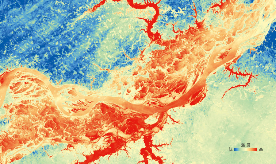
Amazon River. (Single-Band Thermal Infrared Image; Imaging Date: 2022-08-11 Nighttime; Image by AIR)
The Amazon River is located in northern South America and is the largest river in the world in terms of discharge, drainage area, and number of tributaries. In nighttime thermal infrared images, the river water temperature is higher compared to the surrounding rainforest.
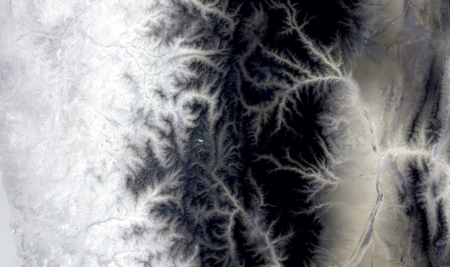
Andes Mountains. (Three-Band Thermal Infrared Image; Imaging Date: 2022-11-02 Nighttime; Image by AIR)
The Andes Mountains are located in South America, extending north to south along the Pacific coast across the entire continent. The mountain range contains abundant mineral resources. In the three-band thermal infrared image, the high-altitude areas in the central part of the mountains exhibit different temperature characteristics compared to the coastal areas on the west and the inland areas on the east.
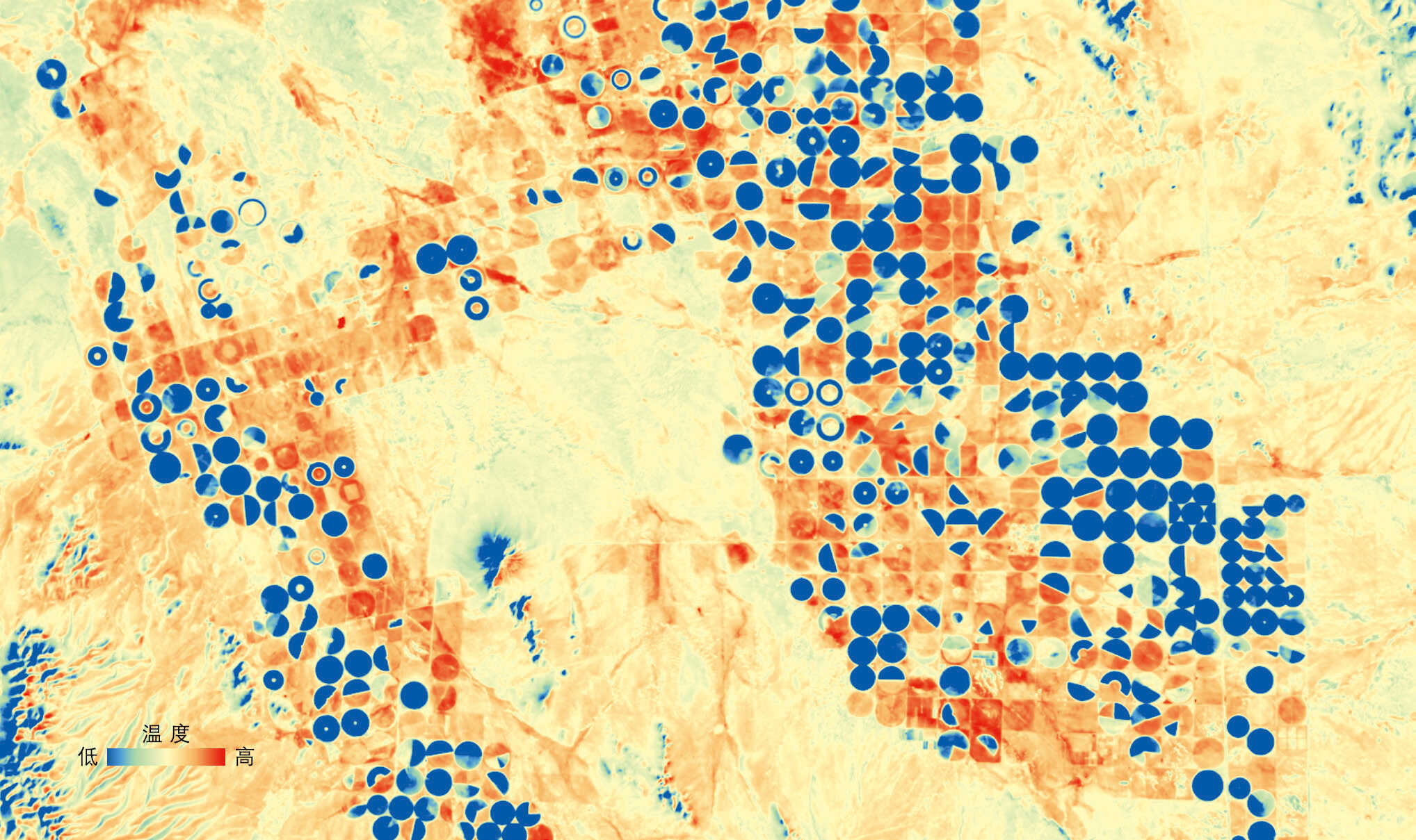
Agricultural Land: Chihuahua. (Single-Band Thermal Infrared Image; Imaging Date: 2024-03-05 Daytime; Image by AIR)
Chihuahua is an inland state in northern Mexico and a significant agricultural production area in the country. The environment within Chihuahua is highly diverse. In the daytime thermal infrared image, the circular irrigated agricultural areas have a lower temperature compared to the surrounding environment.
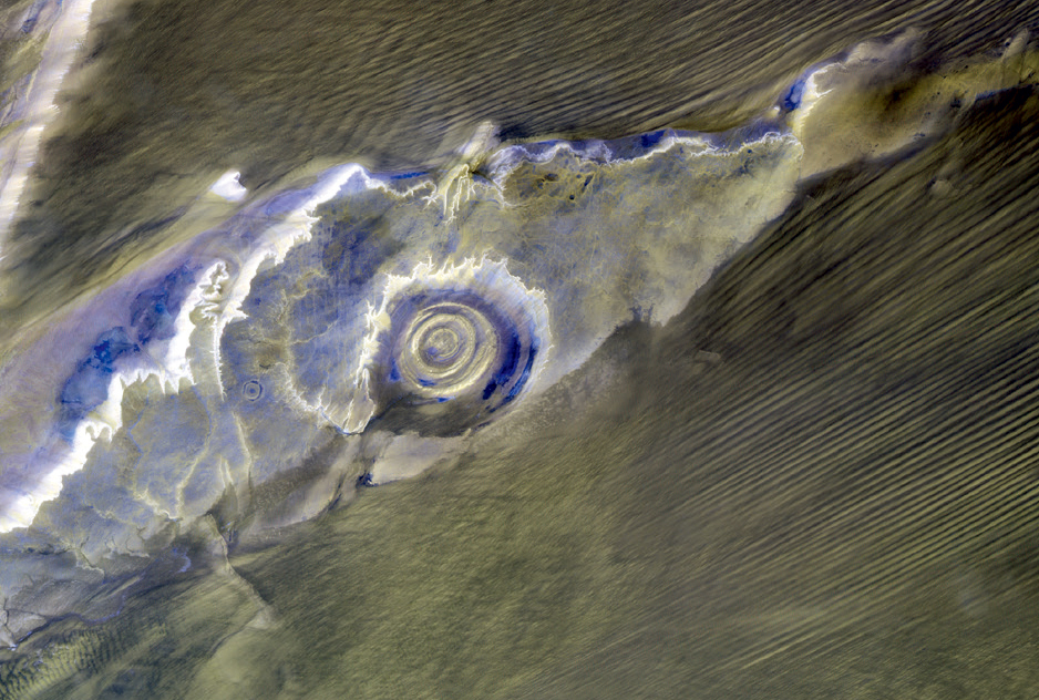
Eye of the Sahara. (Three-Band Thermal Infrared Image; Imaging Date: 2023-11-18 Nighttime; Image by AIR)
The Eye of the Sahara, located in Mauritania, is a massive concentric circular structure with a diameter of 48 km, clearly visible from space. This three-band composite nighttime thermal infrared image shows the thermal differences between the Eye of the Sahara and the surrounding areas, vividly depicting the thermal distribution of the Eye of the Sahara at night.

Wildfire - Northwest Territories, Canada. (Left: True-Color Multispectral Image; Imaging Date: 2023-08-21 Daytime; Right: Single-Band Thermal Infrared Image; Imaging Date: 2023-08-21 Daytime; Image by AIR)
The Northwest Territories of Canada have a frigid climate, close to the Arctic Circle, with winter temperatures reaching as low as -40°C. Wildfires in the region are often caused by lightning, leading to complex impacts on the forest ecosystem. The burned areas are clearly visible in the thermal infrared image, aiding in wildfire monitoring.
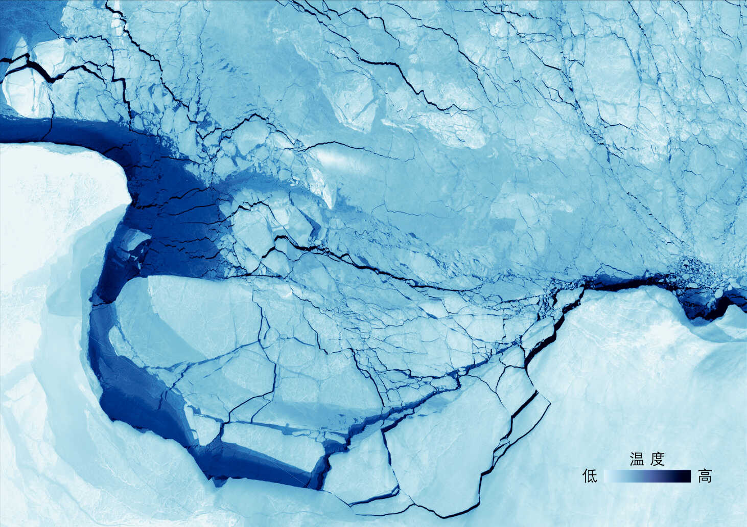
Kara Sea, Off the Coast of Severnaya Zemlya Archipelago. (Single-Band Thermal Infrared Image; Imaging Date: 2023-03-28; Image by AIR)
The Kara Sea is a marginal sea of the Arctic Ocean, located between the northwestern coast of the Asian continent and the islands of Novaya Zemlya and Severnaya Zemlya. The climate in the Kara Sea region is extremely cold, with the area being almost entirely ice-covered year-round.
This image, acquired on March 28, 2023, shows single-band (10.3–11.3 μm) thermal infrared pseudo-color data from SDGSAT-1 off the eastern coast of the Severnaya Zemlya Archipelago in the Arctic Kara Sea. The color gradient from light blue to dark blue represents temperature variations between sea ice and seawater. The large, dark blue banded areas indicate coastal polynyas, where higher-temperature seawater and thin ice are exposed, creating a stark temperature contrast with the thicker floating ice. At a 30-meter resolution, fine cracks in the sea ice (ice leads) are also clearly visible, showcasing rich details.
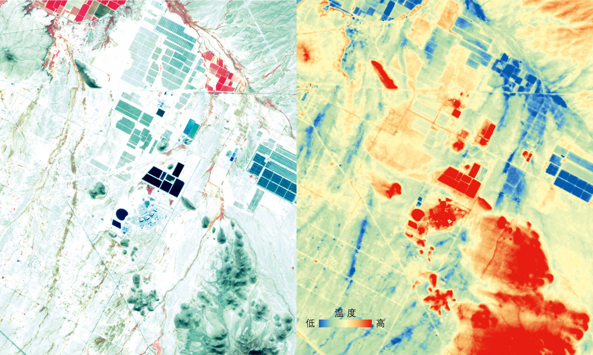
Nuclear Power Plant in Arizona, USA. (Left Image: False-Color Multispectral Image; Imaging Date: 2023-11-04 Daytime; Right Image: Single-Band Thermal Infrared Image; Imaging Date: 2023-10-27 Nighttime; Image by AIR)
This nuclear power plant, located in Arizona, is the only one in the world not situated near a large body of water and the only one in the United States that uses municipal wastewater for cooling. In the nighttime thermal infrared image taken during the fall, areas covered with vegetation are represented by cool tones (blue or earthy yellow). The thermal discharge areas of the nuclear power plant are depicted as extreme heat zones (red).

86-10-68597521 (day)
86-10-68597289 (night)

52 Sanlihe Rd., Xicheng District,
Beijing, China (100864)

