
The satellite Jilin-1 recently sent back a series of images from space showing of lakes in various Chinese deserts.
The satellite family, developed by Changchun-based Changguang Satellite Technology Co, is China‘s first domestic remote-sensing satellite constellation for commercial purposes. It captures super high-definition images and helps with forest fire warnings, desertification, offshore rescue, ocean protection and other remote-sensing information services.
One of the areas photographed is the Badain Jaran Desert in Alshaa league, in the Inner Mongolia autonomous region — one of eight large deserts in China. It covers an area of 49,000 square kilometers and is arid, having annual precipitation of less than 40 mm. It is crisscrossed with faults exposing groundwater at the surface to form lakes in low-lying areas.
Magnificent lakes also exist in some other deserts, including the Tengger Desert in the Inner Mongolia autonomous region, the Mingsha Mountain in Dunhuang and the Jinta Desert in Jinta county, Gansu province. (China Daily)
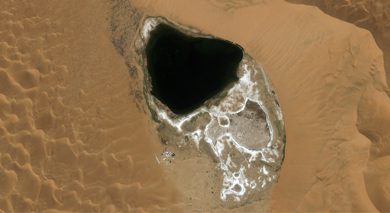
A photo taken by the Jilin-1 satellite shows a lake in the Badain Jaran Desert of Alshaa League of the Inner Mongolia autonomous region. [Photo by Changguang Satellite Technology/For chinadaily.com.cn]
A photo taken by the Jilin-1 satellite shows a lake in the Badain Jaran Desert of Alshaa League of the Inner Mongolia autonomous region. [Photo by Changguang Satellite Technology/For chinadaily.com.cn]

A photo taken by the Jilin-1 satellite shows a lake in the Badain Jaran Desert of Alshaa League of the Inner Mongolia autonomous region. [Photo by Changguang Satellite Technology/For chinadaily.com.cn]

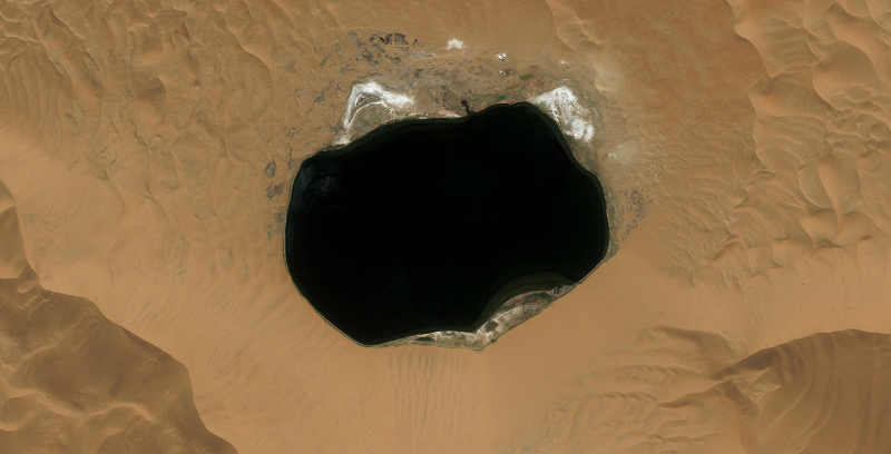
A photo taken by the Jilin-1 satellite shows a lake in the Tengger Desert in Alshaa League of the Inner Mongolia autonomous region. [Photo by Changguang Satellite Technology/For chinadaily.com.cn]

A photo from the Jilin-1 satellite shows a small lake on the edge of the city in the Mingsha Mountain in Dunhuang, Gansu province. [Photo by Changguang Satellite Technology/For chinadaily.com.cn]

A photo from the Jilin-1 satellite shows a lake in the Jinta Desert in Jinta county, Gansu province. [Photo by Changguang Satellite Technology/For chinadaily.com.cn]

Four commercial satellites launched from China’s northwestern spaceport Wednesday, riding into a 400-mile-high orbit on top of a two-stage Long March 2D booster rocket. The four satellites, all made in China, will look down on Earth to collect high-resolution imagery, high-definition video and test new Earth observing technologies, according to Chinese space authorities.
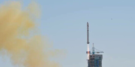
China launched "Jilin-1" – the country's first commercial, remote-sensing satellites at the Jiuquan Satellite Launch Center in Northwest China's Gansu province on Oct 7. They are also the first satellites to be named after a province, marking a big step in the industrialization of this type of space technology.

86-10-68597521 (day)
86-10-68597289 (night)

52 Sanlihe Rd., Xicheng District,
Beijing, China (100864)
Copyright © 2002 - Chinese Academy of Sciences


