
Forests are home to about 80% of the world’s terrestrial biopersity, with more that 60,000 tree species. The United Nations General Assembly proclaimed March 21 the International Day of Forests in 2012 to celebrate and raise awareness of the importance of all types of forests. Countries are encouraged to undertake local, national, and international efforts to organize activities involving forests and trees, such as tree planting campaigns.
With the highest growth in forest coverage and the largest area of man-made forests, China has taken the lead in the global campaign to green the planet. The country's forest coverage and forest reserves have both maintained growth for the last 30 years, and China has realized the largest growth in forest resources among all countries, according to China's white paper on biopersity conservation.
The following are a batch of historic images showing how China turning its land green by launching key projects such as the Three-North Shelterbelt Forest Program, the Farmland-to-Forest Program, as well as the control of the sources of dust storms affecting the cities of Beijing and Tianjin.
Three-North Shelterbelt Program
To improve the ecological environment and increase the forest coverage in northwest, north and northeast China, the Chinese government launched the Three-North Shelterbelt Program (TNSP), which covers 13 provinces (autonomous regions or municipalities) across northern China with a total area of 4.069 million km2. The program started in 1978, and is planned to be completed around 2050,at which point the forest cover will rise from 5.05% to 14.95% in the area.
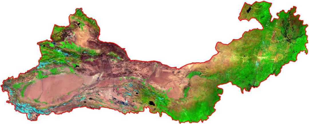
Fig.1. A Landsat image taken in 2021 shows the coverage area of China's Three-North Shelterbelt Program. (Credit to AIR)
The comparison images in Fig. 2, 3 and 4 shows the afforestation in three local areas. In 2009, no trees were planted in the transition zone between the farmland and hills. In 2019, the transition zone and the hill slopes were densely forested (shown in Fig.2).
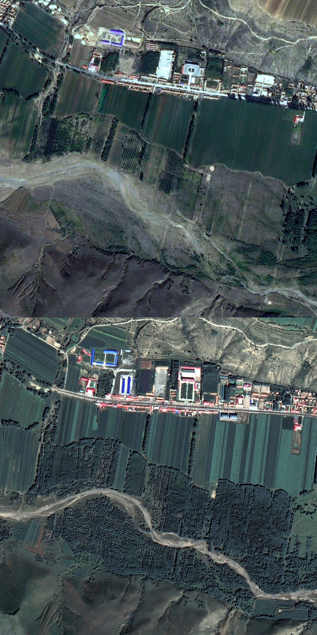
Fig. 2. A local village in Chifeng, Inner Mongolia (top: Google Earth, 2009; bottom: GF-2, 2019). (Credit to AIR)
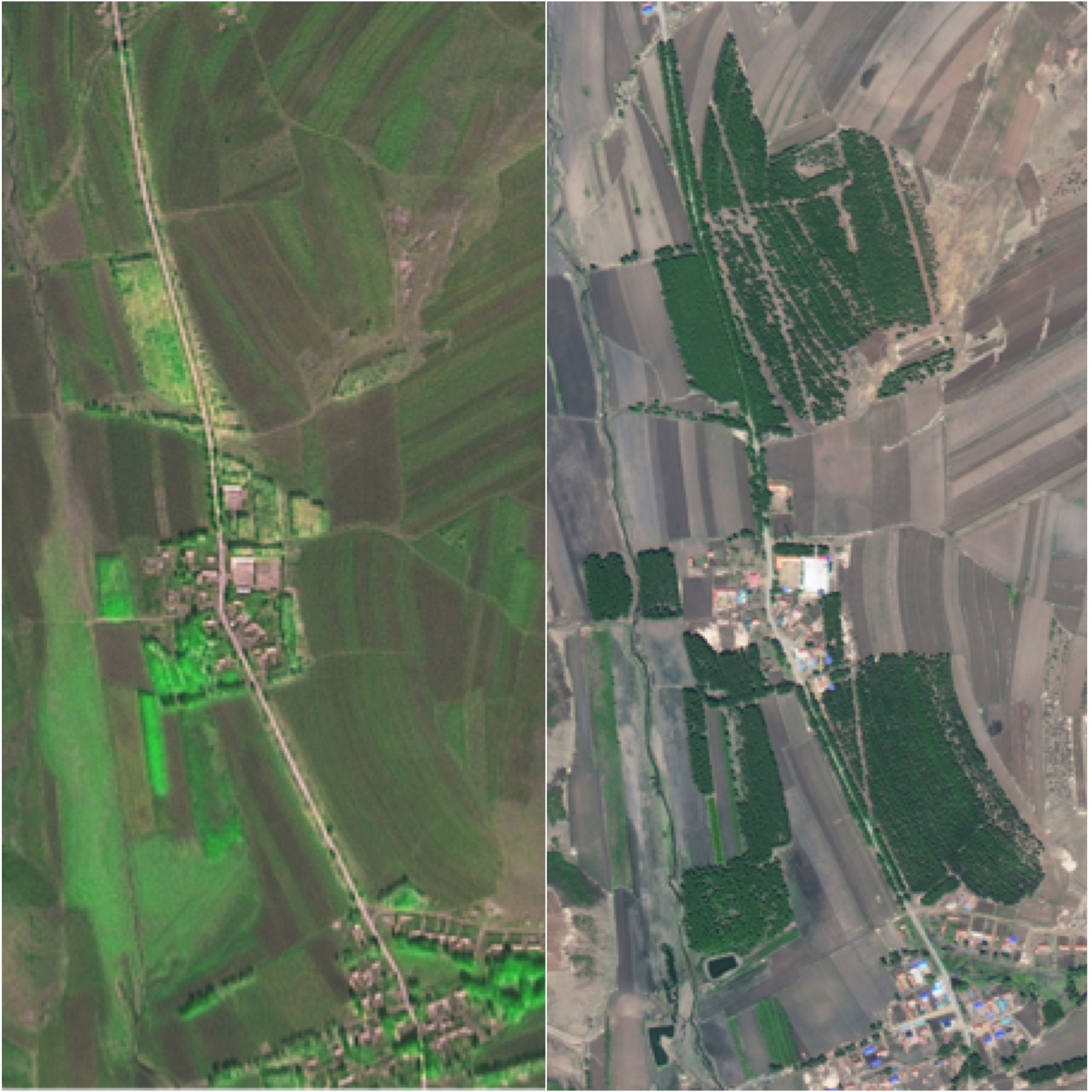
Fig. 3. A local village in Longjiang County, Qiqihar, Heilongjiang Province (left: SPOT-5, 2005; right: GF-2, 2018). (Credit to AIR)
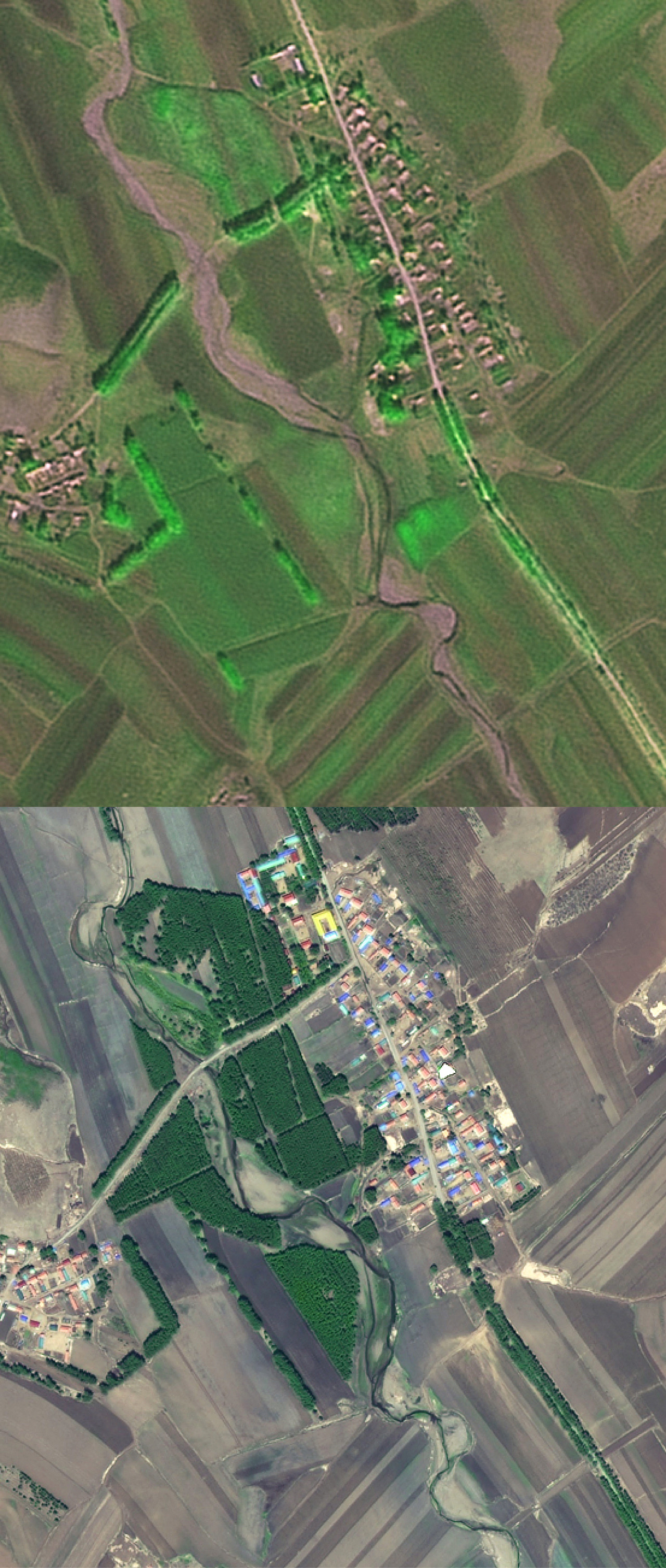
Fig. 4. A local village in Longjiang County, Qiqihar, Heilongjiang Province (top: SPOT-5, 2005; bottom: GF-2, 2018). (Credit to AIR)
Farmland-to-Forest Project in Yan'an, northwestern Shaanxi Province
China launched its Grain for Green program, whereby farmland was returned to forests. It was designed to retire farmland susceptible to soil erosion and flooding. Yan'an City in northwest China's Shaanxi Province has spearheaded the project ever since it was introduced locally in 1998.
To show the progress of returning farmland to forests in Yan'an during the past three decades, three remote sensing images taken respectively by SPOT-1 in 1989, SPOT-5 in 2008, and GF-2 in 2019 were dynamically displayed in Fig. 5.

Fig. 5. Dynamic pictures show the progress of returning farmland to forests project in Yan'an. (Credit to AIR)
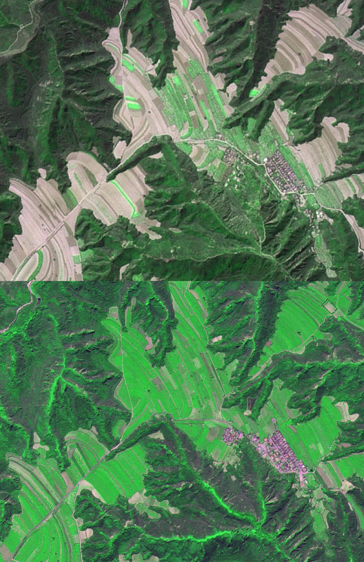
Fig. 6. A local image of Yanchang County, Shaanxi Province (top: SPOT-5, 2008; bottom: GF-2, 2019). (Credit to AIR)
Beijing-Tianjin Sandstorm Source Control Project in Saihanba Forest Farm
The Beijing-Tianjin sandstorm source control project has greatly improved the ecological environment surrounding the Chinese capital and Tianjin Municipality, all the while bringing economic benefits to residents in affected areas over the last two decades.
Located in northern China's Hebei Province, Saihanba was once a royal hunting ground of the Qing Dynasty (1644-1911), but by the late 1950s, it had degraded into an area of barren wilderness. The forestry authority then decided to build an artificial forest farm to block the southward movement of sand land in 1962.
Thanks to consistent efforts of foresters, Saihanba, with a total forest landscape of about 76,700 hectares, has become a national forest park and nature reserve as well as an important ecological shield for Beijing and adjacent regions.

Fig. 7. Dynamic images demonstrate the changes of Saihanba in north China's Hebei Province. (Credit to AIR)
As shown in Fig.8 and 9, two groups of satellite images reveal the changes of Saihanba Forest Farm. Thanks to the program, Saihanba sees large area of artificial forests, as well as significantly increased forest areas.
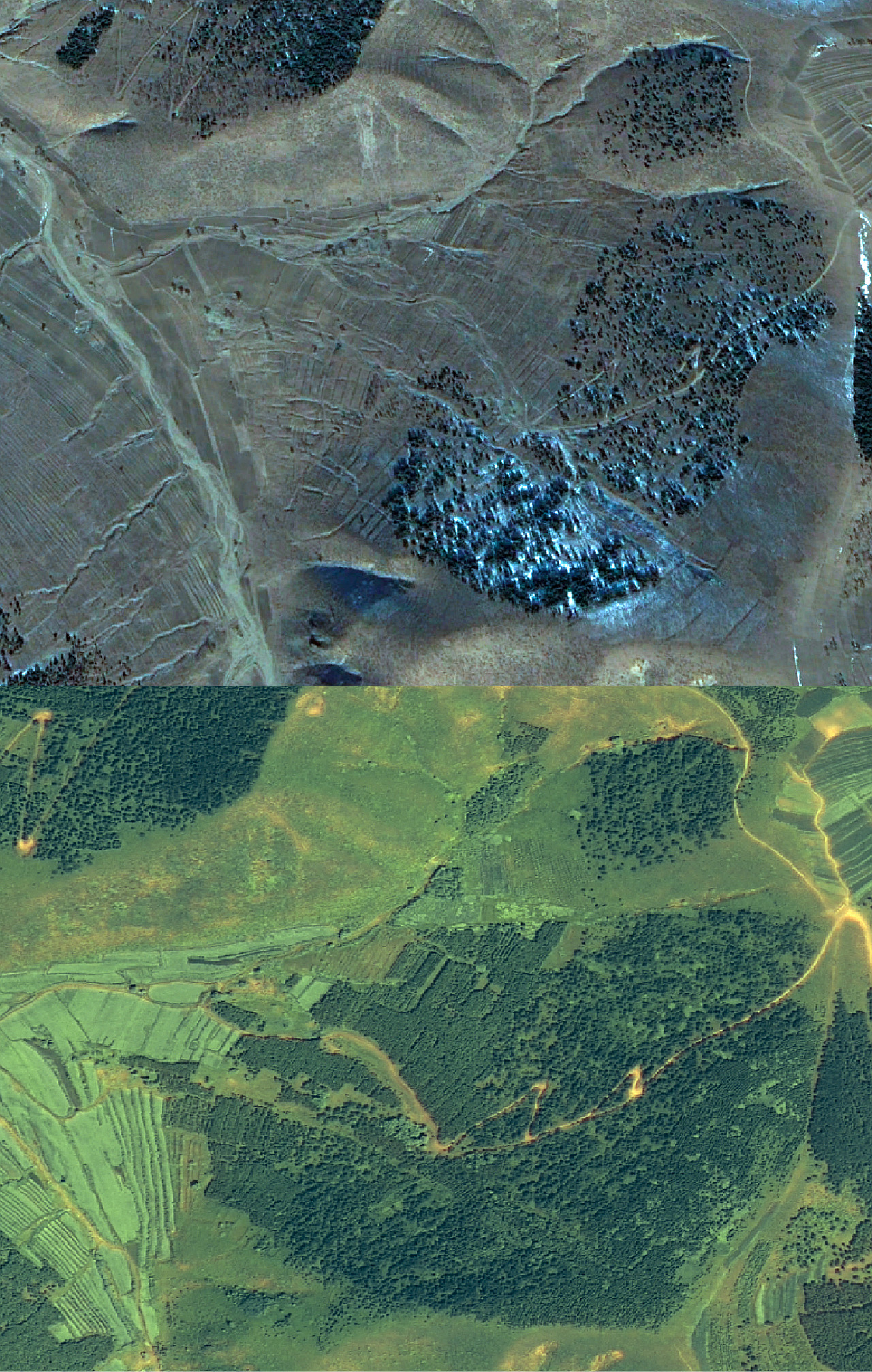
Fig. 8. Local images of Saihanba, Chengde, north China's Hebei Province (top: Google Earth, 2008; bottom: GF-2, 2020) (Credit to AIR)
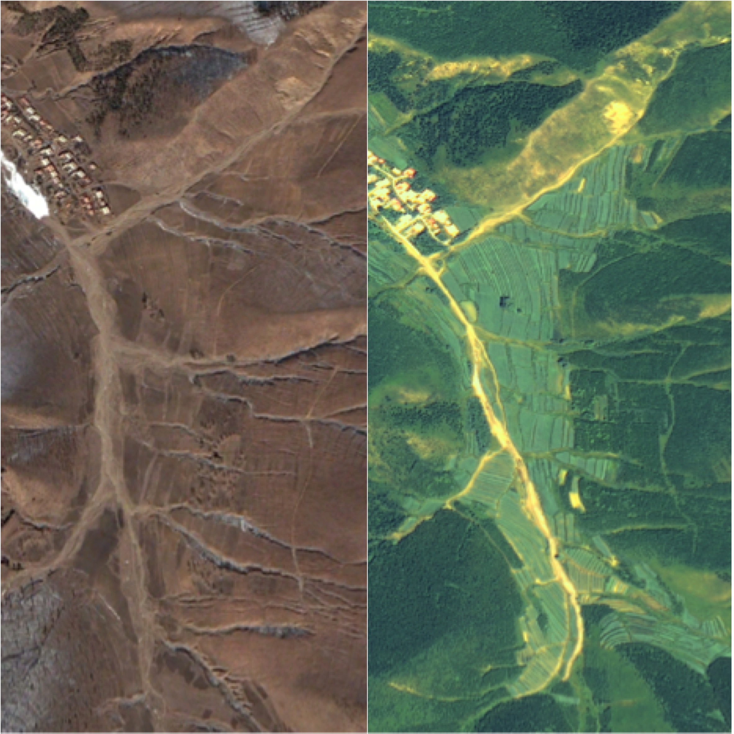
Fig. 9. Local images of Saihanba, Chengde, north China's Hebei Province (left: Google Earth, 2008; right: GF-2, 2020). (Credit to AIR)
In a recent study, researchers from the Xishuangbanna Tropical Botanical Garden (XTBG) provide evidence for the novel future application of biosynthesized silver nanoparticles (PsAgNPs) based nanoformulation for pest management.

86-10-68597521 (day)
86-10-68597289 (night)

52 Sanlihe Rd., Xicheng District,
Beijing, China (100864)
Copyright © 2002 - Chinese Academy of Sciences


