Newsroom


Since 2006, China marks its Cultural Heritage Day on the second Saturday of June each year. Since 2017, the event goes under the name of “Cultural and Natural Heritage Day”, aiming at strengthening public awareness about the importance of safeguarding all types of heritage, and promoting the knowledge about the heritage.
To celebrate this year’s festival falling on June 13, the International Centre on Space Technologies for Natural and Cultural Heritage (HIST), the first UNESCO Category 2 Centre dedicated to the applications of space technologies for the conservation, management and sustainable development of UNESCO-designated sites, is preparing a photo show of several China’s well-known Cultural and Natural Heritage Sites.
The picture exhibition features a combination of satellite images provided by researchers from HIST and the China Remote Sensing Satellite Ground Station (RSGS) under the Aerospace Information Research Institute (AIR) with photos taken by photographers from UNESCO, bringing out the exceptional beauty of these sites from various viewpoints. It is hopeful that the pictures will demonstrate the universal value of these heritage sites for both mankind and the planet, the importance of heritage protection, as well as the unique advantage of space technologies for better heritage monitoring and protection.
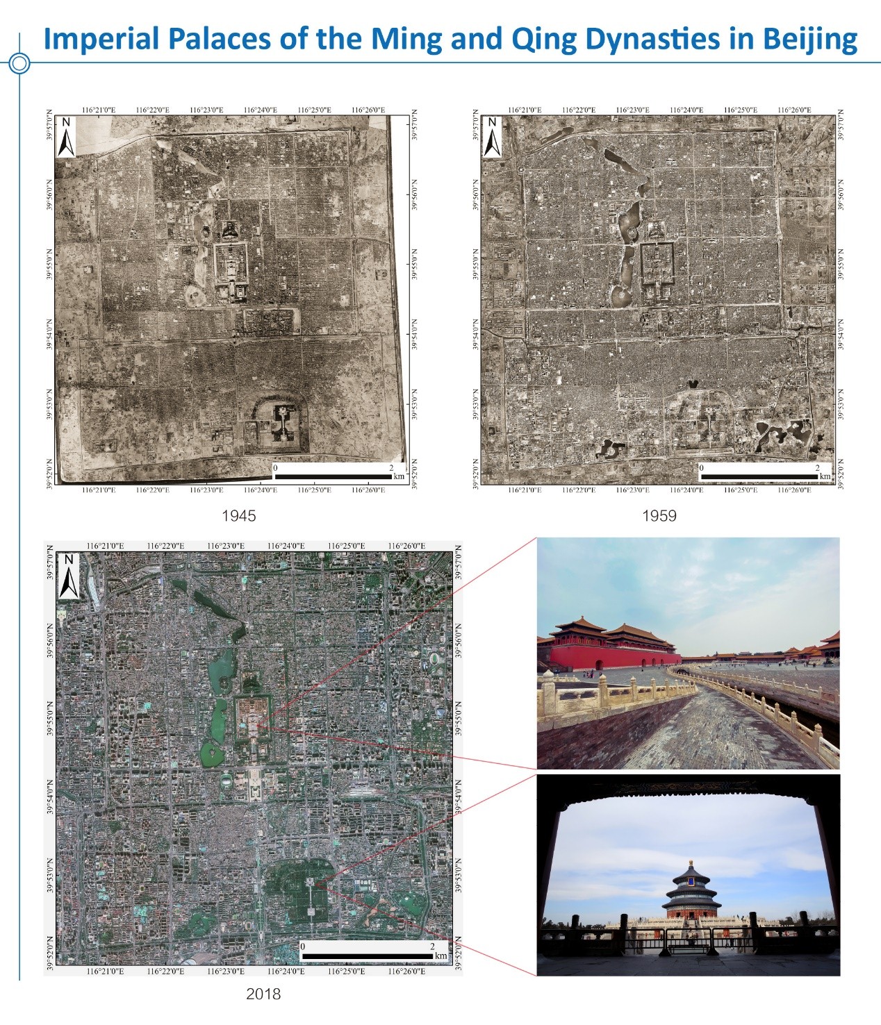
Imperial Palaces of the Ming and Qing Dynasties in Beijing
Seat of supreme power for over five centuries (1416-1911), the Forbidden City located in the centre of Beijing, constitutes a priceless testimony to Chinese civilization during the Ming and Qing dynasties. The layout and spatial arrangement inherits and embodies the traditional characteristic of urban planning and palace construction in ancient China.
Three remote sensing images spanning 70 years show the transition of Beijing as a city of both ancient and modern.
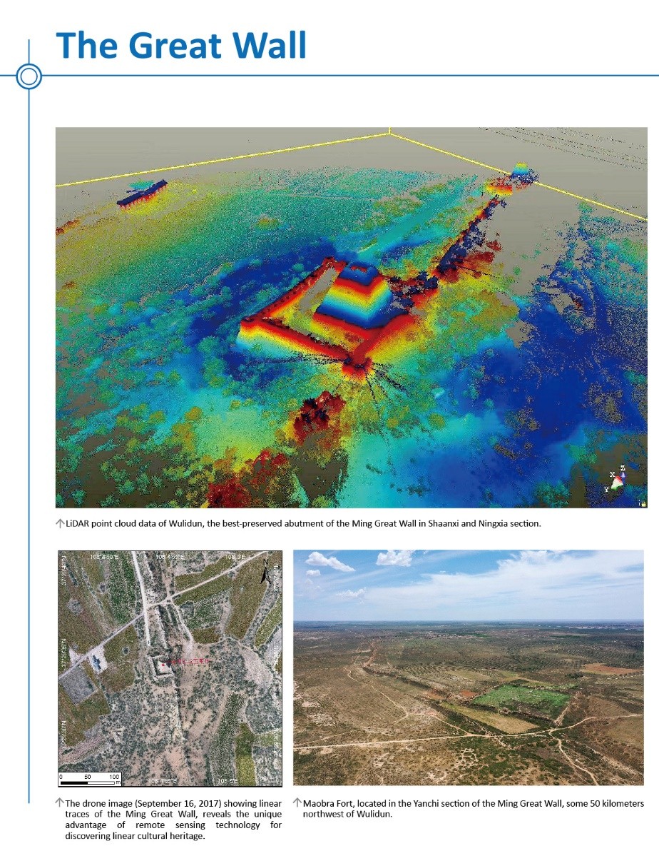
The Great Wall
In c. 220 B.C., under Qin Shi Huang, sections of earlier fortifications were joined together to form a united defense system against invasions from the north. Construction continued up to the Ming dynasty (1368–1644), when the Great Wall became the world's largest military structure. Its historic and strategic importance is matched only by its architectural significance.
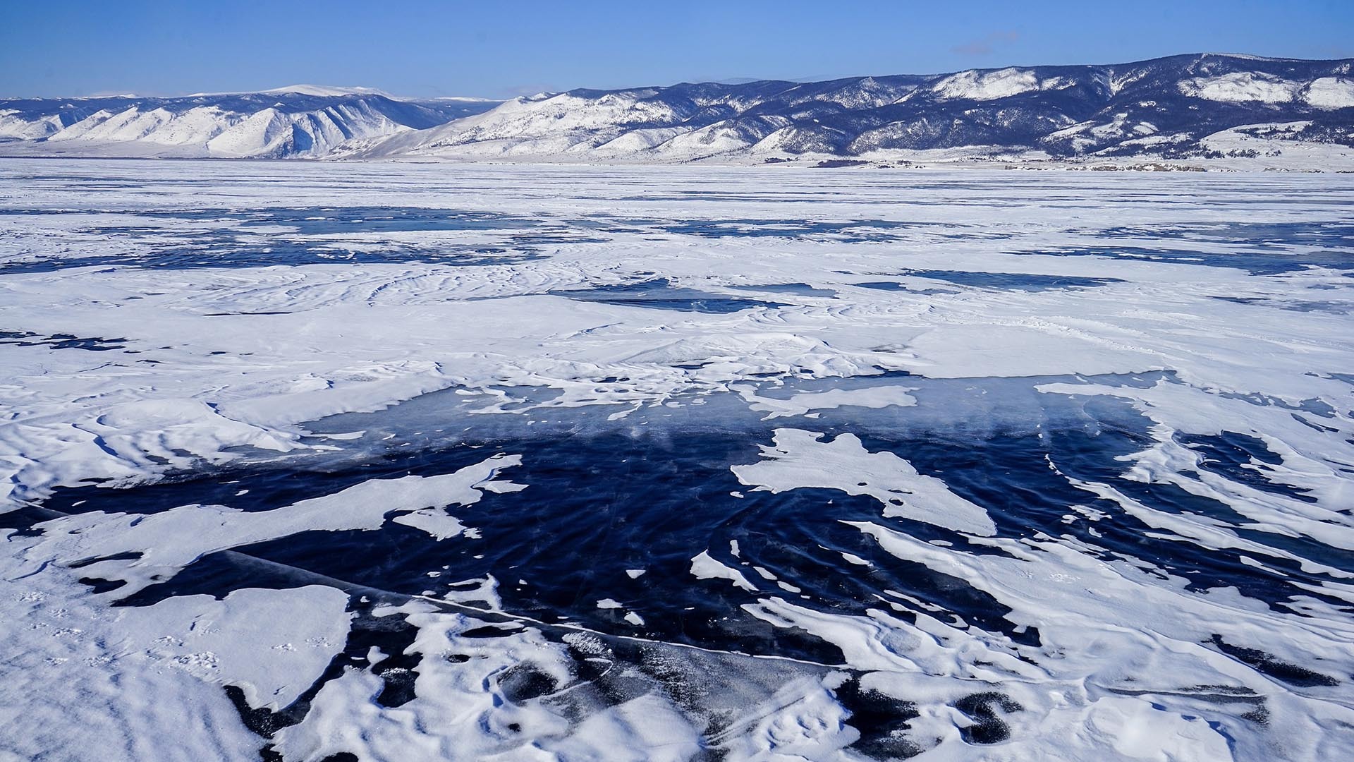
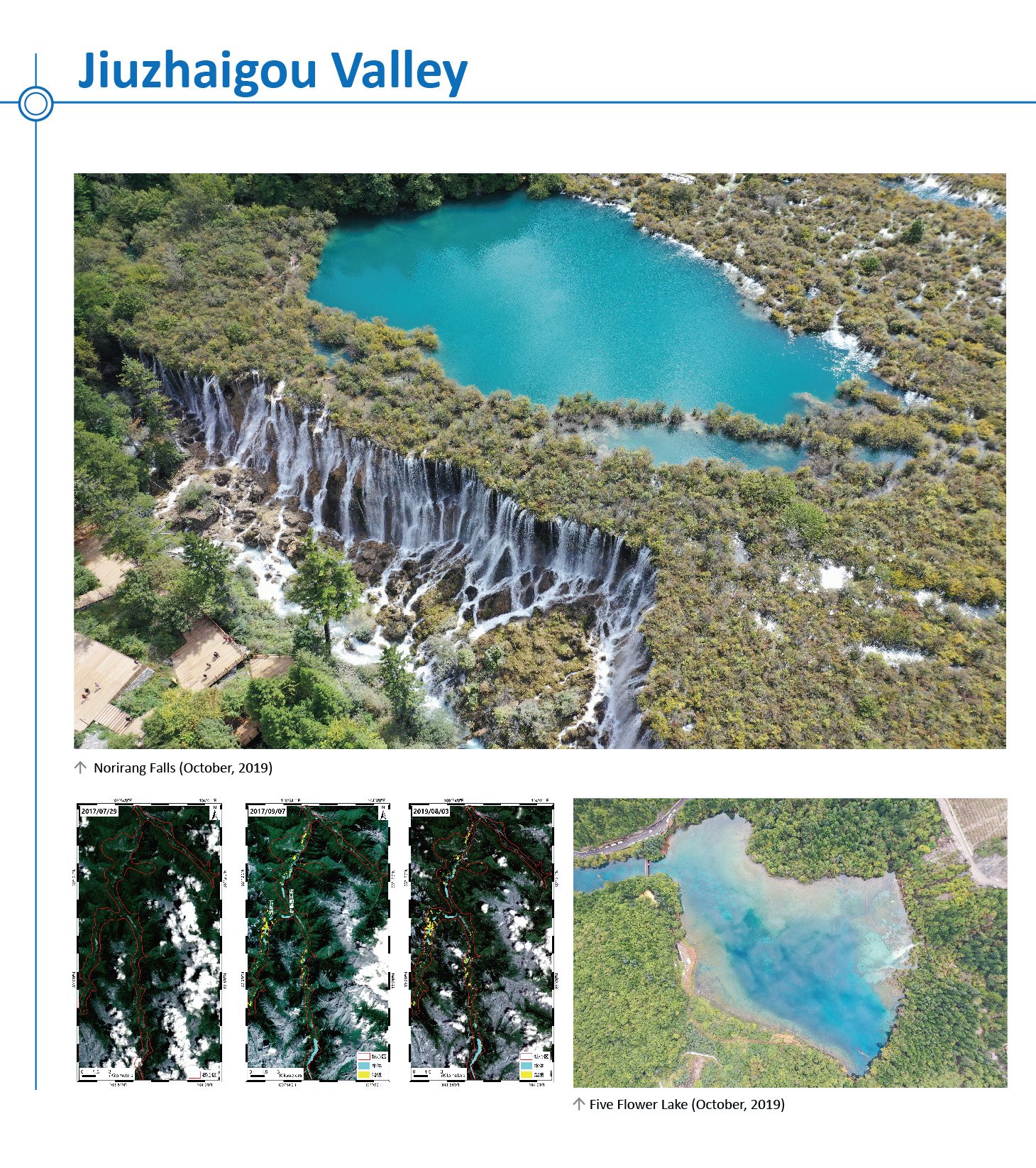
Jiuzhaigou Valley Scenic and Historic Interest Area
Jiuzhaigou is renowned for its scenic and aesthetic majesty. Its fairyland landscape of numerous lakes, waterfalls, and limestone terraces, with their attractive, clear, mineral-rich waters, set in the spectacular alpine mountains with a highly diverse forest ecosystem, demonstrates remarkable natural beauty.
Remote sensing image comparison (before & after August 8, 2017 earthquake) reveals the collapses, landslides, as well as the changes on the landscapes in the area.
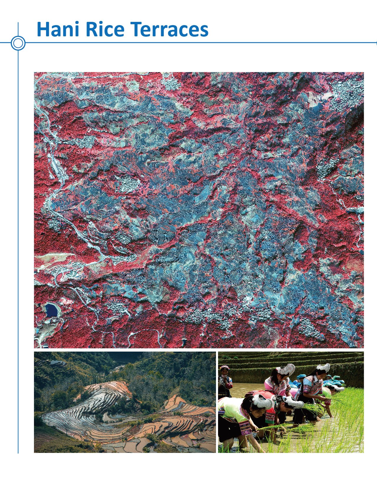
Cultural landscape of Honghe Hani Rice Terraces
The Cultural Landscape of Honghe Hani Rice Terraces, covering 16,603-hectares in Southern Yunnan, is marked by spectacular terraces that cascade down the slopes of the towering Ailao Mountains to the banks of the Hong River. Over the past 1,300 years, the Hani people have developed a complex system of channels to bring water from the forested mountaintops to the terraces.
The GF-2 remote sensing image clearly shows its spatial distribution characteristics and provides a reference for its land utilization, management, and environmental monitoring.
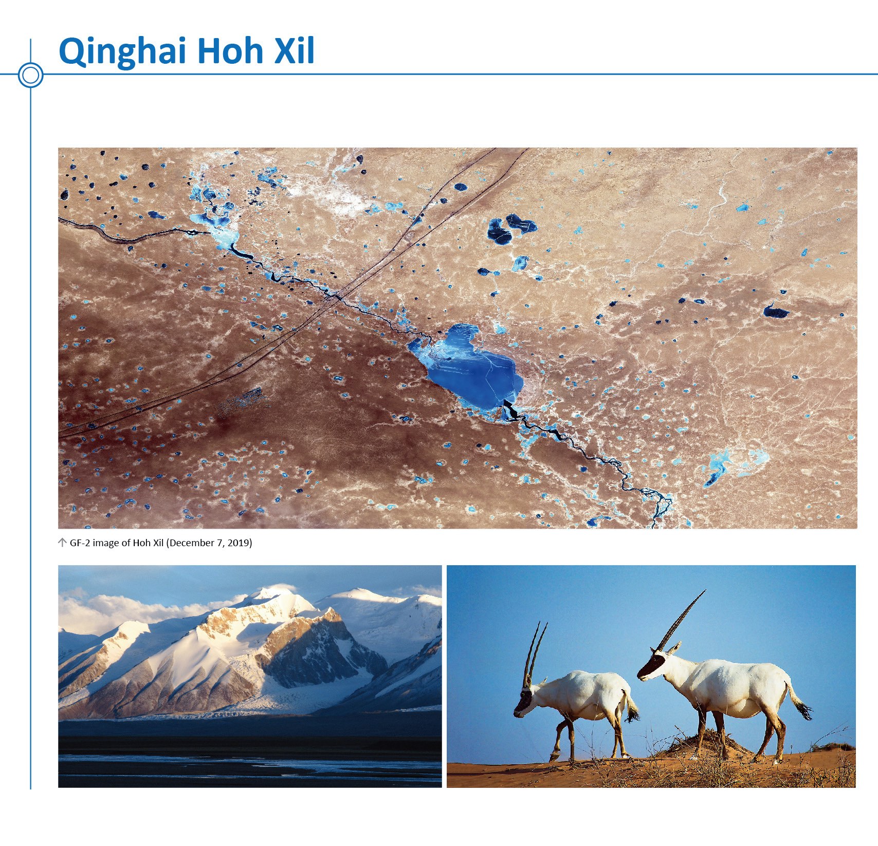
Qinghai Hoh Xil
Qinghai Hoh Xil, located in the northeastern extremity of the Qinghai-Tibetan Plateau, is the largest and highest plateau in the world. The site’s geographical and climatic conditions have nurtured a unique biodiversity. More than one third of the plant species, and all the herbivorous mammals are endemic to the plateau. The property secures the complete migratory route of the Tibetan antelope, one of the endangered large mammals that are endemic to the plateau.
The high-resolution remote sensing image fully shows the distribution of deserts and lakes.
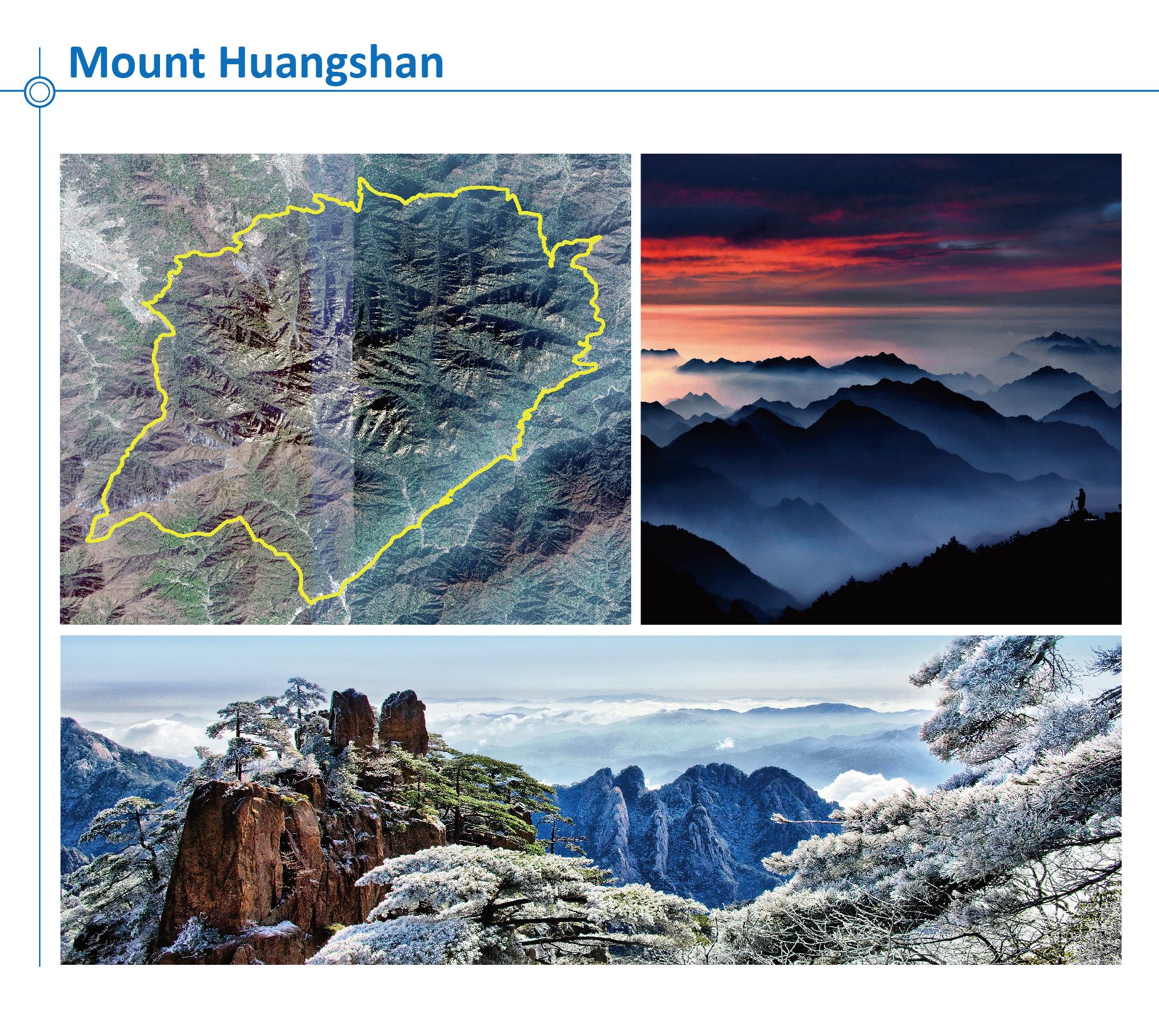
Mount Huangshan
Huangshan, known as “the loveliest mountain of China”, was acclaimed through art and literature during a good part of Chinese history. The site is renowned for its magnificent scenery made up of many granite peaks and rocks emerging out of a sea of clouds.
Huangshan is added to the list of "World Heritage sites" in 1990, the “UNESCO Global Geoparks” in 2004, and the “World Network of Biosphere Reserves” in 2018.
The remote sensing image of Mount Huangshan (the range inside the yellow line) fully displays the distribution of its rocks, vegetation, and scenic resources, providing technical support for disaster monitoring and prevention, efficient conservation, and developing sustainable tourism.
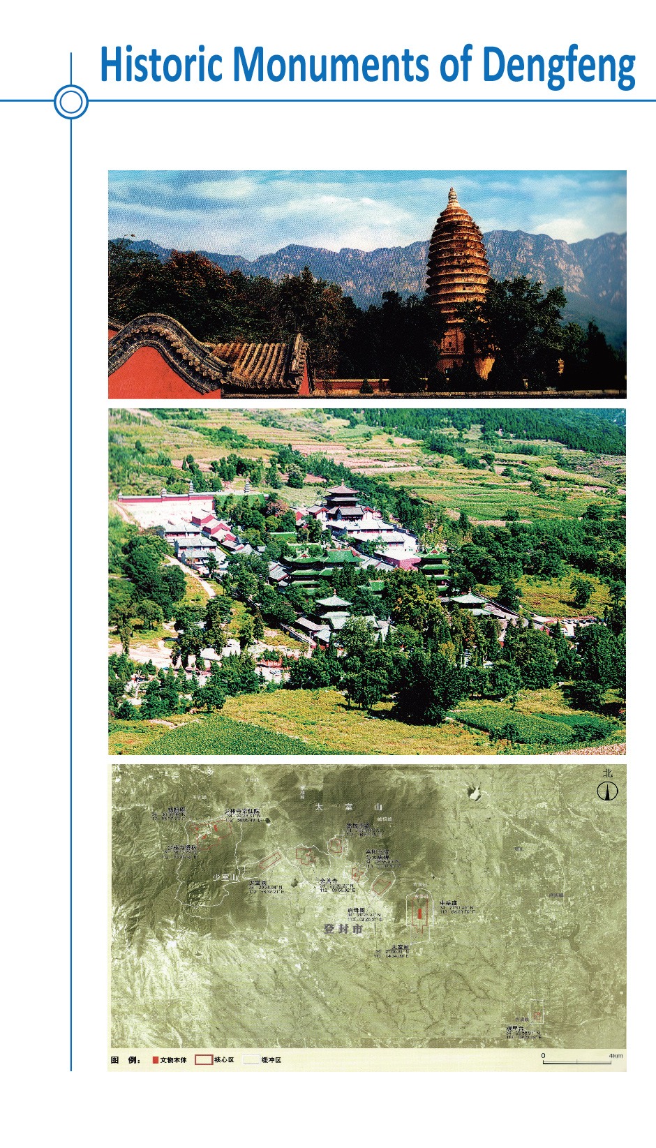
Historic Monuments of Dengfeng in "the Centre of Heaven and Earth"
Mount Songshan is considered to be the central sacred mountain of China. At the foot of this 1,500-metre high mountain, close to the city of Dengfeng in Henan province and spread over a 40 square-kilometer circle, stand eight clusters of buildings and sites. Constructed over the course of nine dynasties, these buildings are reflections of different ways of perceiving the centre of heaven and earth and the power of the mountain as a centre for religious devotion.
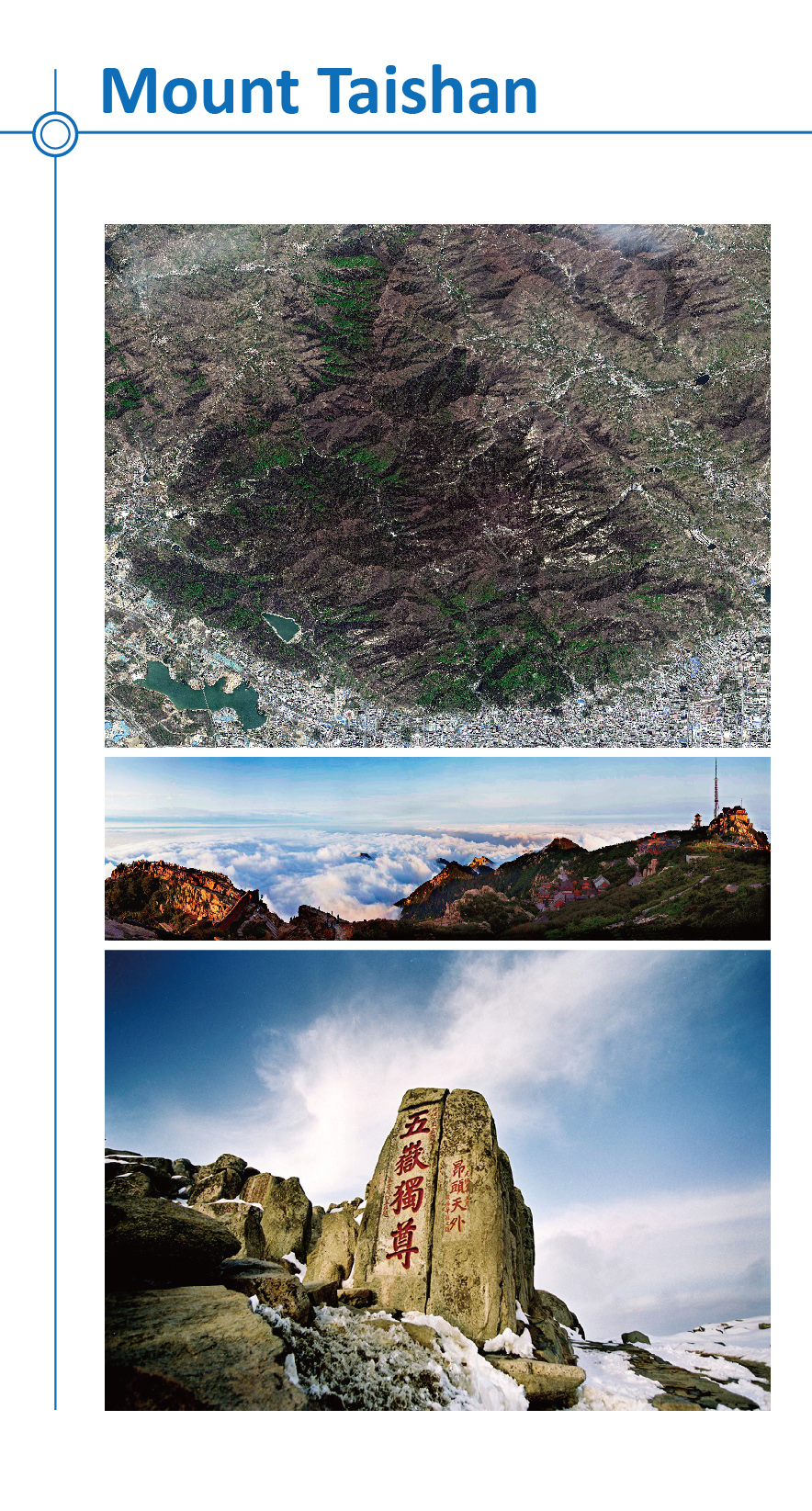
Mount Taishan
The sacred Mount Tai was the object of an imperial cult for nearly 2,000 years, and the artistic masterpieces found there are in perfect harmony with the natural landscape. It has always been a source of inspiration for Chinese artists and scholars and symbolizes ancient Chinese civilizations and beliefs.
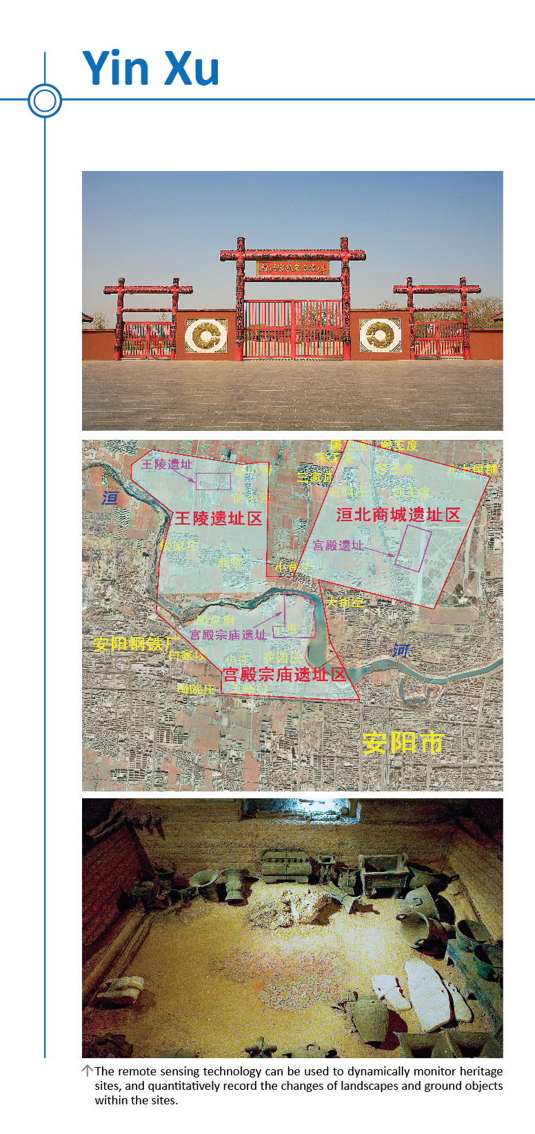
Yin Xu
The archaeological site of Yin Xu, close to Anyang City, is an ancient capital city of the late Shang Dynasty (1300 - 1046 BC). It testifies to the golden age of early Chinese culture, crafts and sciences, a time of great prosperity of the Chinese Bronze Age. Inscriptions on oracle bones found in Yin Xu bear invaluable testimony to the development of one of the world’s oldest writing systems, ancient beliefs and social systems.
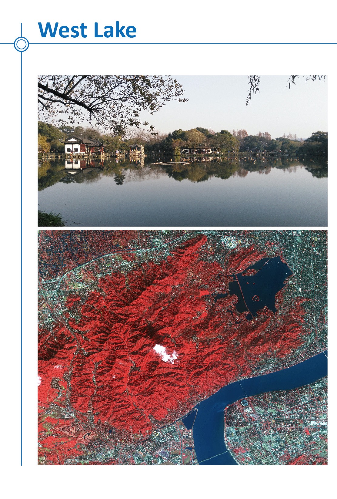
West Lake Cultural Landscape of Hangzhou
The West Lake Cultural Landscape of Hangzhou is composed of the West Lake and the hills surrounding its three sides. It comprises numerous temples, pagodas, pavilions, gardens and ornamental trees, as well as causeways and artificial islands. The West Lake has influenced garden design in the rest of China as well as Japan and Korea over the centuries and bears an exceptional testimony to the cultural tradition of improving landscapes to create a series of vistas reflecting an idealized fusion between humans and nature.
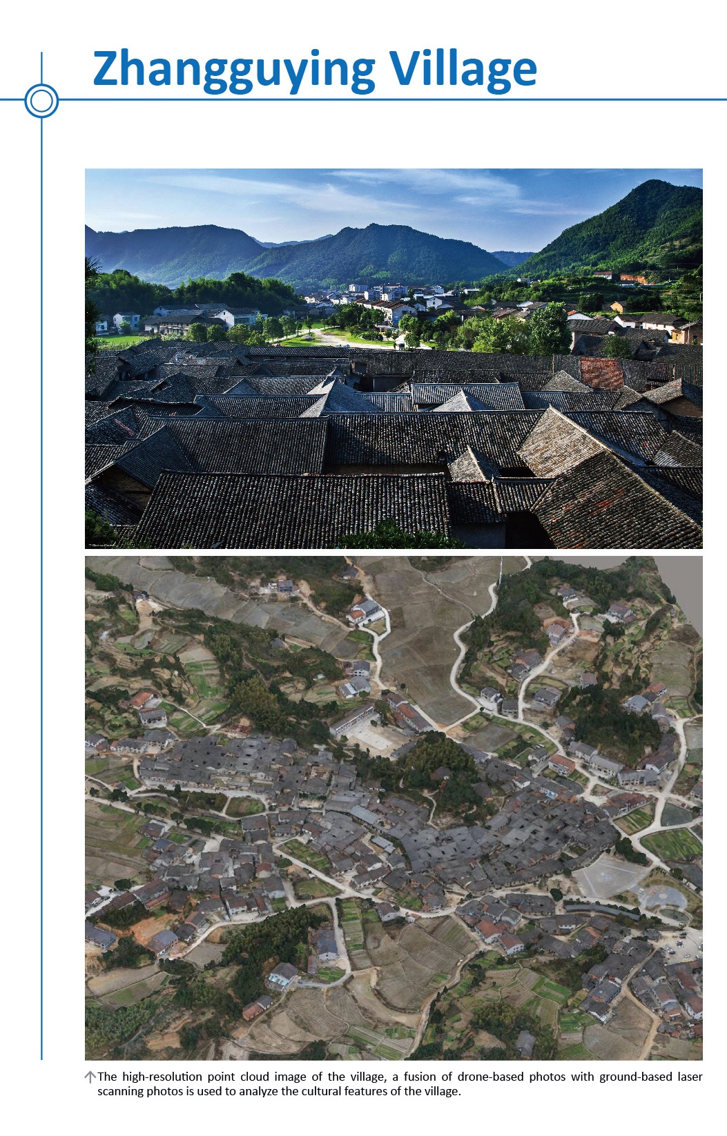
Zhangguying Village
Zhangguying Village is an ancient village located in Yueyang County, Hunan Province. The village, named after the forefather Zhang Guying, is famous for its ancient building complex in the Ming and Qing dynasties. As vernacular residence in scale in the South Central China, the ancient building complex is the best preserved in China. It is constructed broadly in scale and decorated splendidly, with more than 50,000 m2 with 1,732 rooms.
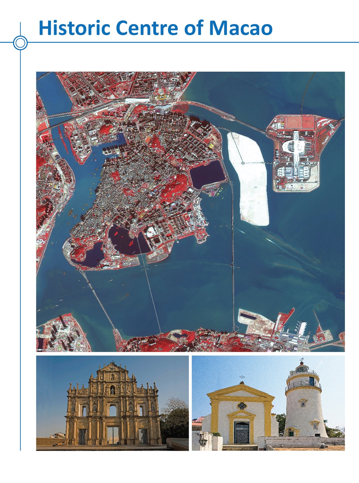
Historic Centre of Macao
Macao, a lucrative port of strategic importance in the development of international trade, was under Portuguese administration from the mid-16th century until 1999, when it came under Chinese sovereignty. With its historic street, residential, religious and public Portuguese and Chinese buildings, the historic centre of Macao provides a unique testimony to the meeting of aesthetic, cultural, architectural and technological influences from East and West.
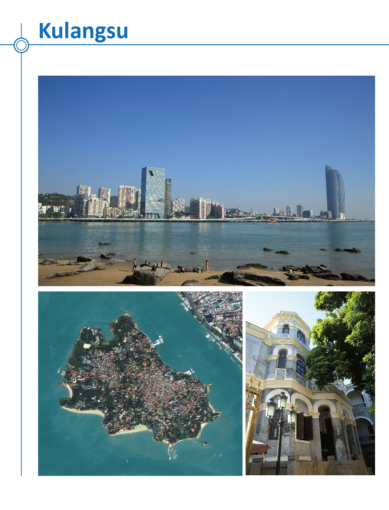
Kulangsu, a Historic International Settlement
Kulangsu is a tiny island located on the estuary of the Chiu-lung River, facing the city of Xiamen. With the opening of a commercial port at Xiamen in 1843, and the establishment of the island as an international settlement in 1903, this island off the southern coast of the Chinese empire suddenly became an important window for Sino-foreign exchanges. Kulangsu is an exceptional example of the cultural fusion that emerged from these exchanges, which remain legible in its urban fabric. There is a mixture of different architectural styles.
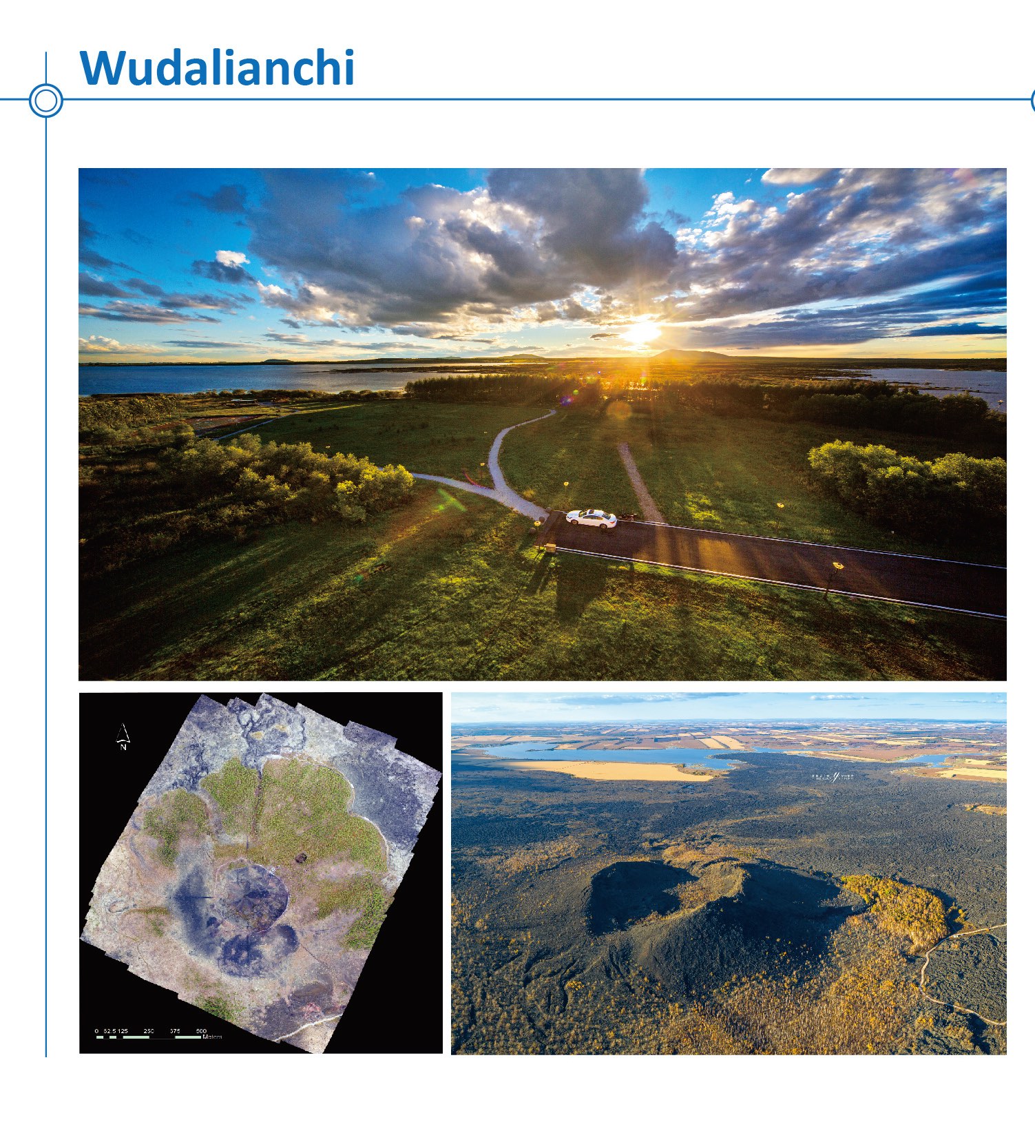
Wudalianchi UNESCO Global Geopark
Wudalianchi UNESCO Global Geopark, situated in the middle-north part of Heilongjiang Province, mainly consists of fourteen young and old volcanoes which erupted in different periods, five lava dammed lakes, many cold mineral springs formed from volcanic eruptions and extensive lava plateaus. Wudalianchi possesses undamaged typical volcano geology and geomorphology and is regarded by geologists as a “Natural Volcano Museum” and a “Living Textbook on Volcanoes”.
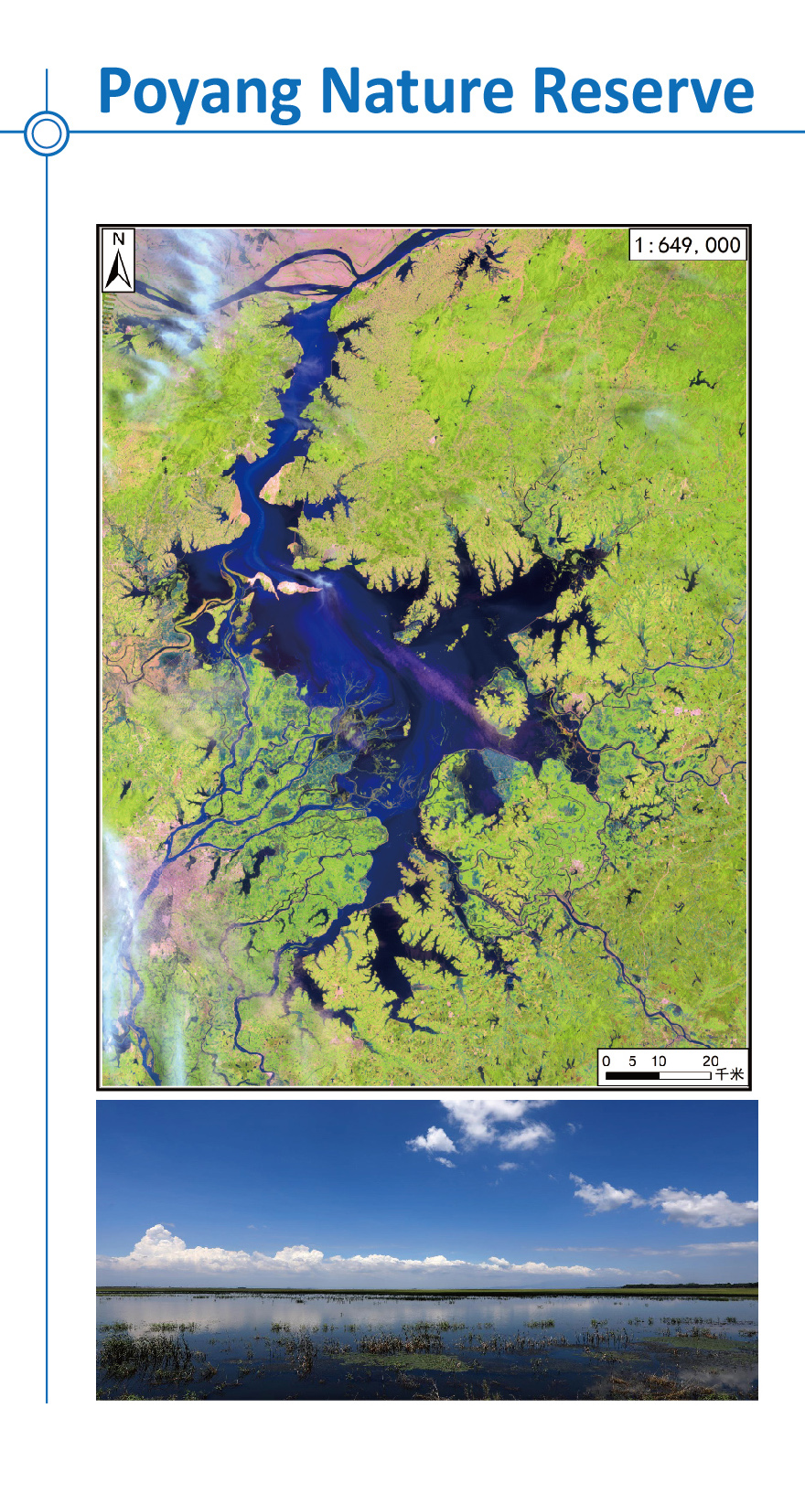
Poyang Nature Reserve
Situated in northern Jiangxi, Poyang Lake, the largest fresh water lake in China, lies to the south of the middle and lower reaches of the Yangtze River. The lake has been well known as "a land of abundance" and is reputed as a "bright pearl" in the basin of the Yangtze River with its rich aquatic resources and flourishing crops in surrounding fertile lands.
Acknowledgements
Most of sites demonstrated on the picture exhibition benefit from HIST research projects in China. Some of site descriptions are extracted from UNESCO website. The copyrights of the pictures, unless specifically noted, belong to UNESCO, HIST, RSGS, and AIR.