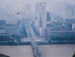
Hexi Corridor, an important section of the ancient Silk Road and the modern Euro-Asian Railway, is one of the key regions for the drive of "great development of China's west." However, the accelerated urbanization process in this arid area has brought to the forefront a number of key problems, such as resource exploitation and eco-environmental deterioration.
With the support of the National Natural Science Foundation of China, Prof. FANG Chuanglin, a geographer with the Institute for Geographic Sciences and Natural Resources Research, and his colleagues started studies on urbanization and its ecological effects in 2003.
Taking the Hexi Corridor as a case and the water resources restriction as the precondition, the researchers have made explorations on the coupling mechanism of the urbanization process and the eco-environment change process of the region with an area of 276,000 square kilometers falling in five administrative areas.
Using the system integration method and the RS and GIS technology, Fang and his team located the driving factors for the conflictions between the changes of water resources and the urbanization process. They also analyzed the ecological effects caused by the urbanization process and related to water resources.As a result of the four-year hard work, the study sheds new light on the understanding of the mechanism and laws behind the conflictions.
On the basis of Water Resources Carrying Capacity, largest scale of population and economy in a certain area according to the total water resources, the securable technology, and the socio-economic development level within a certain period, the researchers introduced the new concept of Water Resources Constraint Force, which refers to the pressures of a water resource system on a socio-economic system. It shows that when the population, economic and urban scales approach or exceed the water resources carrying capacity, or the utilization of water resources approaches or exceeds the threshold of natural water resources, the water resources system will be highly stressed by the socio-economic system. Consequently, the water resources system will slow down the socio-economic development, including the process of industrialization and urbanization.
Using a threshold model developed by them, the researchers made predictions on the possible urbanization level of the Corridor over the next 30 years. According to their computation, by 2030, the cities in the Corridor may accommodate additional 870,000 immigrants from the rural areas, enabling the urbanizing level reach 35.14% if no water transfer is carried out into the area. In the scenario of water diversion from other areas, up to 1.58 billion m3 water resources might be exploited, raising the local urbanization level to 47.17%.
Based on the case study, the scientists suggested a model for a sound development of urbanization drive in China, which could harmonize the drive with the ecological setting and water resources in the cities. Scientists believe that the project is of critical significance, both in theoretical and practical terms, in the enforcement of the scientific outlook on development, enriching the disciplinary contents of China's science of urban geography as well as construction of resource-saving and green cities throughout the country.


