Newsroom


The CropWatch team of the Aerospace Information Research Institute (AIR), Chinese Academy of Sciences (CAS), releases the world's first 30-meter resolution global cropping intensity dataset (GCI30) by using multi-source remote sensing imagery. With an overall accuracy of 92.9%, the dataset can depict the overall pattern of global cropping intensity with much better spatial details than previous ones.
The dataset indicates that single cropping is the primary agricultural system on the Earth, accounting for 81.57% (12.28 million km2) of the world's cropland extent. Multiple-cropping systems, on the other hand, are commonly observed in South America and Asia. In addition, large variations are found across countries and agroecological zones, reflecting the joint control of natural and anthropogenic drivers on regulating cropping practices.
The global distribution of cropping intensity (CI) is essential to our understanding of agricultural land use management on the Earth. Due to the diverse cropping practices and the various agriculture landscapes across the globe, the retrieval of cropping intensity at high resolution with satisfactory accuracy is of great challenge.
Optical remote sensing has revolutionized our ability to map CI over large areas in a repeated and cost-efficient manner. In this study, the CropWatch team utilizes multiple satellite data on cloud platform to develop this global, spatially continuous cropping intensity dataset at 30-m resolution.
As the world's first global coverage cropping product with fine-resolution, GCI30 is expected to fill the data gap for promoting sustainable agriculture by depicting worldwide diversity of agricultural land use intensity.
The dataset also provides scientific data support for the evaluation of relevant UN sustainable development goals such as zero hunger.
The GCI30 dataset is accessible at https://doi.org/10.7910/DVN/86M4PO.
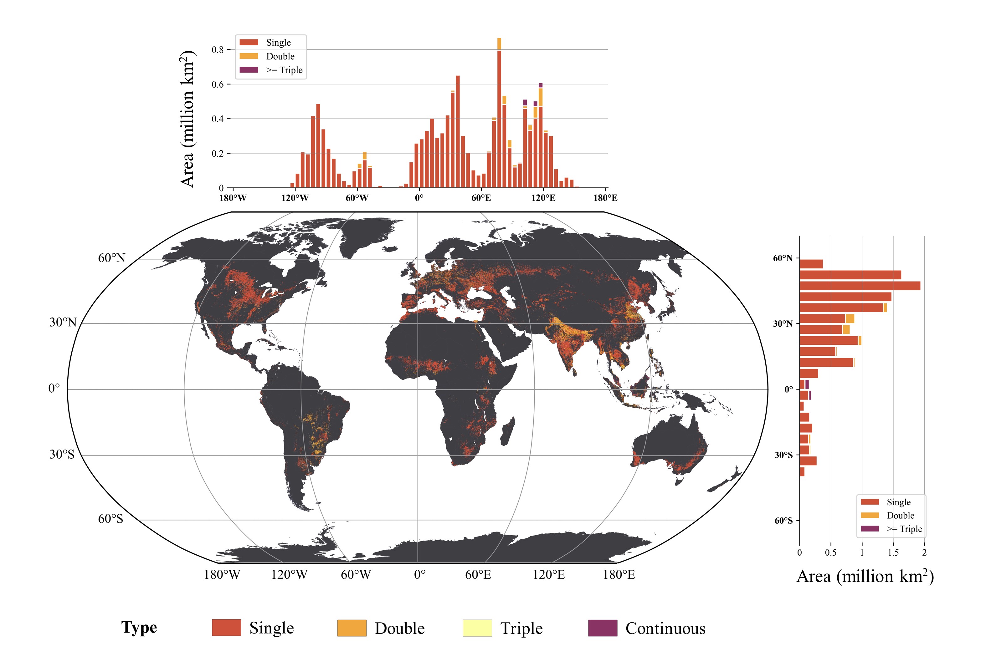
The global dataset of 30-m cropping intensity using multisource remote sensing imagery (GCI30) (Image by AIR)