Newsroom


Chinese researchers recently released an integrated observation dataset of the hydrological and thermal deformation covering permafrost engineering and slope areas in the Qinghai-Tibet Engineering Corridor (QTEC).
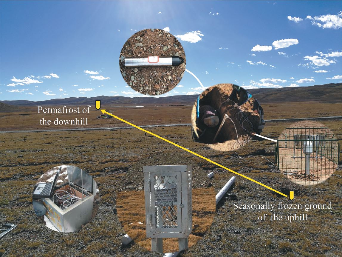
This synthesis dataset for permafrost engineering and slopes includes measured air and ground temperatures and moisture, mean annual air temperature, mean annual ground surface temperature, terrestrial laser scanning point cloud data, and RGB and thermal infrared images.
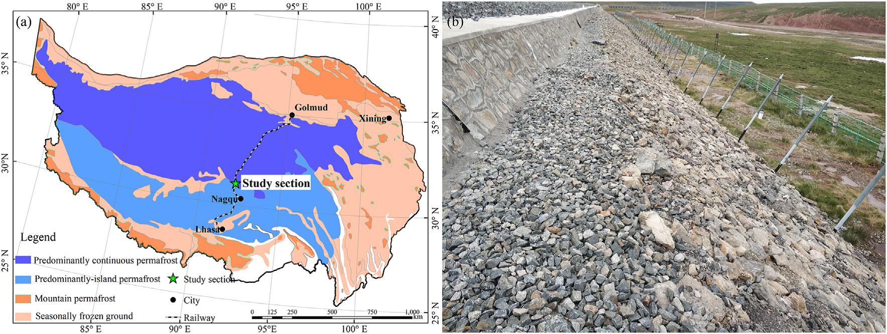
QTEC is a narrow engineering corridor with widely distributed slopes, where a variety of important infrastructures are concentrated. However, slope failures caused by permafrost degradation and ground ice melting in permafrost regions happened frequently, endangering the safety of large facilities in the QTEC. Therefore, it is necessary to conduct a long-term monitoring of geological activities in this area.
Researchers from the Northwest Institute of Eco-Environment and Resources of the Chinese Academy of Sciences (CAS) implemented a variety of sensors to monitor the hydrological and thermal deformation between permafrost slopes and permafrost engineering projects in the corridor.
They also used soil temperature and moisture sensors to monitor hydrothermal changes, and adopted global navigation satellite system (GNSS), terrestrial laser scanning (TLS) and UAVs to observe the spatial distribution of thermal deformation.
To fully understand and leverage existing datasets and to allow for full transparency and repeatability, the researchers also provide comprehensive information and metadata, including complete documentation of the dataset and technical methods.
The dataset will be of great value to examine the hydrological and thermal deformation of permafrost slopes under the influence of climate change and engineering disturbances, as well as to reveal the mutual feedback between the slopes and engineering infrastructure.
In addition, this dataset also evaluates the potential hazards of long-term stability and safety operation of the engineering infrastructure and slopes, and provides data support for the safety range and layout of the proposed permafrost engineering infrastructure.
The research has been published in Earth System Science Data entitled "An integrated observation dataset of the hydrological and thermal deformation in permafrost slopes and engineering infrastructure in the Qinghai–Tibet Engineering Corridor."