Newsroom


The mountain landscape is a result of battle between tectonic uplift, river incision and bedrock landsliding. The erosion of landslide dominates the process of removing sediment from the watersheds; therefore, where it happens is important for the landscape evolution.
If landslides occur repeatedly in particular parts of a mountain range, then they will dominate the landscape evolution of that section and could leave a fingerprint in the topography.
An international research team discovered that erosion after large earthquakes preferred to remove sediments from high elevations by triggering landslides, while the landslides caused by the intense rainfall eroded sediment from the lower elevation. Their study was published in Science Advances.
The study was conducted by researchers from the Institute of Earth Environment of the Chinese Academy of Sciences, Durham University, Victoria University of Wellington, University of Otago and NERC Radiocarbon Facility.
The research team collected sediment cores from Lake Paringa and soil samples on New Zealand's west coast of South Island. This sediment cores recorded four earthquakes with Mw > 7.6 in the last 1000 years.
To examine where the lake sediment comes from, the researchers used a range of geochemistry techniques, including the carbon and nitrogen isotopes and a specific compound of organic matter in the sediments, known as biomarkers. Their shifts after each large earthquake suggested that the sediment sources had been changed by large earthquakes.
Using the relationship between the organic geochemistry proxies and the soil elevation and depth, they calculated that the earthquake triggered landslide eroded organic matter from elevations around 700 meters; while the sediments were eroded from a lower elevation around 450 meters when there was no earthquake. These results, for the first time, proved that repeated large earthquakes can consistently focus erosion at high elevations.
The research is important for the understanding the dynamics of landscape evolution in mountain ranges. The results suggested that large earthquakes trigger landslides at the elevations of drainage divide, which is the boundary of two rivers/tributaries. Therefore, large earthquakes are the primary process driving drainage divide migration at the mountain ranges, which is a key process changing the landscape and the river networks.
The research team demonstrates that extreme events, such as earthquakes and storms, may exert a first-order influence on landscape evolution.
The work was supported by grants from National Natural Science Foundation of China, Durham University COFUND Junior Research Fellowship, Natural Environment Research Council Standard Grant, and Rutherford Foundation Postdoctoral Fellowship.
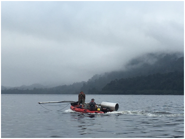
Collecting lake sediment core from the Lake Paringa, New Zealand (Image by WANG Jin)