

China to Launch HD Observation Satellite This Year
Jul 22, 2014 Email"> PrintText Size

China will launch Gaofen-2, a high-definition Earth observation satellite, to space this year, according to the State Administration of Science, Technology and Industry for National Defense (SASTIND).
As one of China's major science and technology projects, the Gaofen satellite series will help in geographic and resources surveys, environment and climate change monitoring, precision agriculture, disaster relief and city planning.
Launched in April last year and still in service, Gaofen-1 provided data on the Lushan earthquake in Sichuan; floods in northeast China; and smog in north and east China during the test period. It also provided Pakistan with image data after an earthquake which happened on Sept. 24.
Gaofen-1 was the first of five or six satellites to be launched for high-definition Earth observation before 2016. It is also the first low-orbit remote-sensing satellite designed to be in use for longer than five years.
Equipped with better technology, Gaofen-2 will be able to see a one-meter-long object in full color.
Wu Zhenyu, researcher with the Development Research Center of the State Council, said the project will boost the development of China's remote sensing industry and ensure more effective social management. (Xinhua)
CAS Institutes
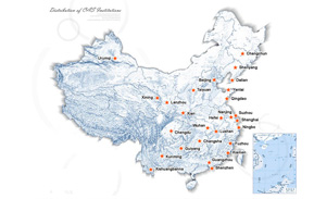
There are 124 Institutions directly under the CAS by the end of 2012, with 104 research institutes, five universities & supporting organizations, 12 management organizations that consist of the headquarters and branches, and three other units. Moreover, there are 25 legal entities affiliated and 22 CAS invested holding enterprisesThere are 124 I...>> more
Contact Us

Chinese Academy of Sciences
Add: 52 Sanlihe Rd., Xicheng District, Beijing, China
Postcode: 100864
Tel: 86-10-68597592 (day) 86-10-68597289 (night)
Fax: 86-10-68511095 (day) 86-10-68512458 (night)
E-mail: cas_en@cas.cn