

China to Complete Integrated Mapping System by 2020
Mar 12, 2013 Email"> PrintText Size

China will build up an integrated mapping system to cover the ground, underground, sea, air and outer space by 2020, said a senior official of the national surveying and mapping authority.
The system, when completed, will facilitate the country's economic development, national defense and government decision-making, Li Pengde, deputy director of the National Administration of Surveying, Mapping and Geoinformation, told Xinhua News Agency in an interview late Monday.
It will also provide spatial position information conducive for the government to cope with emergencies and for people to live with greater convenience.
For this purpose, said Li, the system will adopt new-generation equipment and technologies, including surveying vehicles and vessels, medium- and low-altitude remote sensing mapping platforms, aerospace mapping satellites and underground measuring robots.
China has made substantial progress in developing this equipment and technology, the official added. (Xinhua)
CAS Institutes
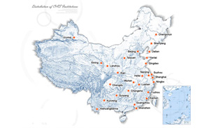
There are 124 Institutions directly under the CAS by the end of 2012, with 104 research institutes, five universities & supporting organizations, 12 management organizations that consist of the headquarters and branches, and three other units. Moreover, there are 25 legal entities affiliated and 22 CAS invested holding enterprisesThere are 124 I...>> more
Contact Us

Chinese Academy of Sciences
Add: 52 Sanlihe Rd., Xicheng District, Beijing, China
Postcode: 100864
Tel: 86-10-68597592 (day) 86-10-68597289 (night)
Fax: 86-10-68511095 (day) 86-10-68512458 (night)
E-mail: cas_en@cas.cn