

Researches Analyze Desert Riparian Forest Colonization in the Lower Reaches of Tarim River Basing on Remote Sensing
Jun 03, 2014 Email"> PrintText Size

As the popular ‘‘Green Corridor’’ in history, riparian vegetation of the lower reaches of Tarim River (the largest inland river in China) seriously damaged from the 1950s because of human activities. For rescuing Green Corridor and control desertification, the ecological water conveyance project (CNY 10.7 billion), which pipes water from Daxihaizi reservoir to the Lower Reaches of Tarim River, has been implemented since 2000. After ecological water conveyance, restoration has taken place for vegetation along the dried-up lower reaches of the Tarim River. The changes of vegetation fluctuated yearly due to ecological water conveyance.
In order to reveal the detailed process of vegetation changes, LIU Guilin et al. classified remote sensing images from 1999 to 2010 into vegetated and non-vegetated areas using the soil-adjusted vegetation index threshold method, and then obtained inter-annual changes of vegetation over a period of 12 years using a post-classification change detection technique. On the above basis, LIU Guilin et al. analyzed spatial–temporal changes distribution of vegetation cover and its response to ecological water conveyance.
The results show that vegetation area increased by 8.52 % overall after ecological water conveyance. Although vegetation restoration is obvious from 1999 to 2010, vegetation loss also existed. The results indicate that vegetation restoration fluctuated due to ecological water conveyance. Spatial distribution of vegetation restoration presented ‘‘strip’’ distribution along the river and group shaper in the lower terrain area, while spatial distribution of vegetation loss mainly located in the upper reaches of river and area far away from the river. Vegetation restoration area had a positive relative with total ecological water conveyance volume. That is, the scheme and season of ecological water conveyance had also influenced the vegetation restoration.
The findings suggest that the monitoring of vegetation change process, based on continuous remote sensing data, can provide the spatial–temporal distribution of vegetation cover in a large-scale area and scientific evidences for implementing ecological water conveyance in the lower Tarim River. The study was published in Environmental Earth Sciences in May 2014.
CAS Institutes
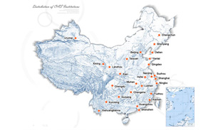
There are 124 Institutions directly under the CAS by the end of 2012, with 104 research institutes, five universities & supporting organizations, 12 management organizations that consist of the headquarters and branches, and three other units. Moreover, there are 25 legal entities affiliated and 22 CAS invested holding enterprisesThere are 124 I...>> more
Contact Us
Chinese Academy of Sciences
Add: 52 Sanlihe Rd., Xicheng District, Beijing, China
Postcode: 100864
Tel: 86-10-68597592 (day) 86-10-68597289 (night)
Fax: 86-10-68511095 (day) 86-10-68512458 (night)
E-mail: cas_en@cas.cn