

China Releases Geoinformation Industry Plan
Jul 27, 2014 Email"> PrintText Size

China issued its first development plan for the geographic information industry, according to an announcement from China's National Administration of Surveying, Mapping and Geoinformation.
China sees the geoinformation industry as a new source for economic growth and plans to establish a comprehensive industry system with independent intellectual property rights by 2020.
China will focus on developing remote sensing services as well as manufacturing surveying and mapping equipment and navigation systems, according to the plan.
The country will actively support leading enterprises and strengthen the training of innovative talents in the field, the plan said.
China's independently-developed Beidou navigation satellite system achieved positioning accuracy within one meter in May and is expected to be applied in sailing, marine exploration and rescue, and maritime monitoring.
The Beidou navigation satellite industry alone will have an output value of 400 billion yuan (about 65 billion U.S. dollars) by 2020, according to a geo-spatial information expert. (Xinhua)
CAS Institutes
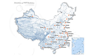
There are 124 Institutions directly under the CAS by the end of 2012, with 104 research institutes, five universities & supporting organizations, 12 management organizations that consist of the headquarters and branches, and three other units. Moreover, there are 25 legal entities affiliated and 22 CAS invested holding enterprisesThere are 124 I...>> more
Contact Us

Chinese Academy of Sciences
Add: 52 Sanlihe Rd., Xicheng District, Beijing, China
Postcode: 100864
Tel: 86-10-68597592 (day) 86-10-68597289 (night)
Fax: 86-10-68511095 (day) 86-10-68512458 (night)
E-mail: cas_en@cas.cn