"The 65 countries within the ‘Belt &Road’ regions are facing some common challenges,” introduced Prof. GUO Huadong, Member of both CAS (the Chinese Academy of Sciences) and TWAS (the World Academy of Sciences for the advancement of science in developing countries), at the opening of the “International Symposium on Earth Observation for One Belt and One Road (EOBAR)”. GUO welcomed the delegates on May 16 as Chairman of the Symposium: “Taking advantage of Earth observations, we might be able to address such problems better.” Citing global environmental change, food security, protection of world heritage sites, unbalanced economic and urban development, disaster risk assessment and other issues calling for cooperation across borders, he proposed a new concept called the “Digital Belt and Road (DBAR)” and advocated a grand program named the “Digital Belt and Road Initiative” to cope with common economic, developmental and environmental challenges pertinent to involved countries.
Grand Initiative
In 2013, Chinese President XI Jinping proposed an initiative to create a New Silk Road along the historical Silk Road, a network of trade routes through Asia connecting the East and West from ancient China to the Mediterranean Sea. Together with the Maritime Silk Road (officially the 21st Century Maritime Silk Route Economic Belt), and later iterated and abbreviated as the "the Belt and Road Initiative”, the initiative represents China’s most grand framework for international cooperation since its establishment in 1949, and an effort to seek reciprocal ways of economic and social development for the 65 countries along the Belt and Road. Following this great blueprint, GUO proposed the DBAR initiative on behalf of the CAS Institute of Remote Sensing and Digital Earth (RADI), urging efforts from involved countries and international organizations to promote bilateral and multilateral collaboration in Earth observation, as well as early involvement of decision makers in strategic research, planning and necessary fund raising.

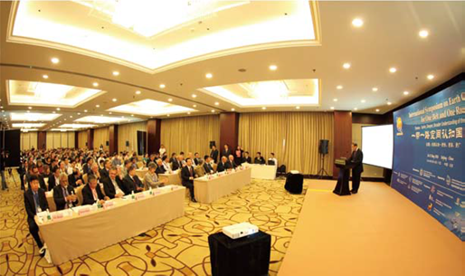
A view from the conference. (Photo: Courtesy of RADI.)
The Symposium on EOBAR, sponsored by the CAS Academic Division of Earth Sciences and hosted by RADI, attracted over 300 participants from over 40 countries. Participants included scientists, leaders of scientific organizations and government officials in charge of S&T affairs coming from Belt and Road regions, engaging in research on Belt and Road and the applications of spaceborne Earth observation technologies. Revolving around the theme of “Earlier, Deeper, Broader Understanding of the Belt and Road”, the conference aimed to provide an international platform for discussing rising issues in fields where Earth observation has found important applications, such as infrastructure and capacity building, spaceborne observation for the economic belts along the Belt and Road, urban layout and construction, world heritage site protection, and space technologies for disaster mitigation. The brainstorming at the symposium, as anticipated by the organizers, might help establish needed platforms and mechanisms for proper technology/ data sharing and enhanced cooperation.

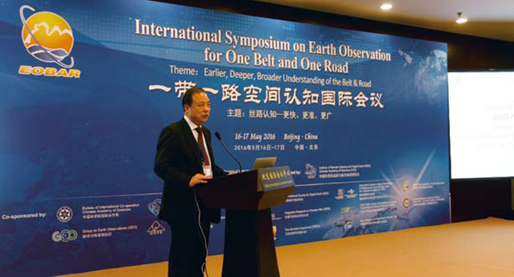
Symposium Chairman Prof. GUO Huadong addresses the EOBAR opening. (Photo: Courtesy of RADI.)
"Challenges like climate change, like disaster risk… all these must be addressed across borders, and this requires international cooperation. We believe that people in countries along the Belt and Road are aware of the benefit brought by the Initiative,” remarked GUO when addressing the opening of the EOBAR. “Earth observation, valued for its quick, dynamic data production, is an effective approach for Belt and Road to address such common issues.”
"Countries have borders; Earth observations don’t.” Just like science, it knows no borders, Prof. GUO emphasized. A renowned expert in radar for Earth observations and applications, GUO presently serves as President of the International Society for Digital Earth (ISDE). Meanwhile he also heads the International Centre on Space Technologies for Natural and Cultural Heritage (HIST) under the auspices of UNESCO, and the CASTWAS Centre of Excellence on Space Technology for Disaster Mitigation (SDIM).
Echoing GUO’s ideas, Ms. Barbara Ryan, Secretariat Director of the Intergovernmental Group on Earth Observations (GEO), expressed her support for the DBAR Initiative and the event in her brief address on behalf of GEO.
"I just want to say on behalf of the Group of Earth Observations that we very much applaud the efforts of China and its partners for the One Belt One Road initiative,” she said. “I can tell you that for us in Earth observations, initiatives like this are absolutely essential for realizing the power of Earth observations.” “While working at a global level,” she explained: “it is going to be really important to down scale the international global efforts to more regional areas and then ultimately international areas. ... You know countries of the world are spending a lot of money on the collection of Earth observations, whether they are from space or ground, whether to the atmosphere or the rain and coastal areas … and we absolutely must leverage Earth observation if we are going to address society’s biggest environmental problems.”